
NASA satellite shows Lac Megantic disaster was visible from space

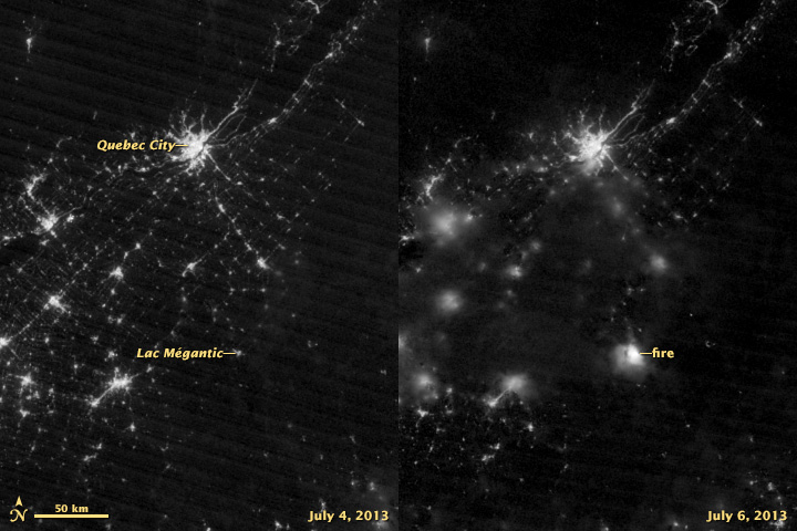
NASA's Earth Observatory released a new composite photograph today, which really brings home the magnitude of the tragedy in Lac Megantic, Quebec, as it shows how the explosion and resulting fire caused by the train derailment there was so big, it could actually be seen from space.
[ Related: Quebec sends $60M in aid to Lac-Megantic as scope of disaster grows ]
Captured by the Suomi NPP satellite — an 'earth-observing' satellite in a polar orbit around the planet that takes continuous images to track the changing face of our world, including observing weather and tracking disasters — the left-hand image was taken on July 4th, and the right-hand image was taken at around 3 a.m. EDT, a couple of hours after disaster struck the town. Although clouds are partially blocking the view from the 6th, the bright flames from the burning oil are clearly visible, and possibly even surpassing the collective lights of Quebec City.
[ More Geekquinox: Thunderstorm warnings in southern Ontario could mean more flooding for Toronto ]
As of the latest reports, 15 people have been confirmed dead, with another 45 people are still missing, and a total of 40 buildings — homes and businesses, both — were destroyed in the explosion and fire.
(Image courtesy: NASA Earth Observatory)
Geek out with the latest in science and weather.
Follow @ygeekquinox on Twitter!
