
Super typhoon Haiyan goes off the scale on approach to the Philippines


Raging super typhoon Haiyan has become so powerful as it approaches the Philippines that it has actually gone off the scale, surpassing the maximum level of 8.0 to become a magnitude 8.1 storm.
Wind speeds in this incredible storm — which is known as Yolanda in the Philippines — have been measured at 305 km/h, and wind gusts have reached up to 370 km/h. By comparison, Hurricane Wilma in 2005, currently ranked as the most powerful tropical cyclone ever recorded, had wind speeds maxing out at 295 km/h, and an Atlantic storm only needs to reach wind speeds higher than 252 km/h to become a category 5 hurricane. Different storm scales are used for different parts of the world, but one that sees more universal use is the Dvorak scale, which ranks from 1.0 to 8.0.
According to what meteorologist Eric Holthaus wrote on Quartz:
Within the last hour, one real-time estimate of the storm’s intensity has actually ticked slightly above the maximum to 8.1 on an 8.0 scale. This meteorologist, for one, has never seen that before.
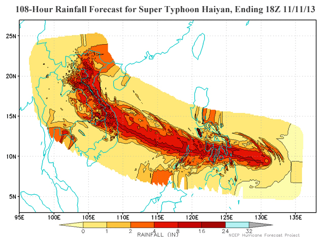
Thousands are being evacuated in the Philippines ahead of the storm, and several regions of the Visayas Islands are now under the strongest storm alerts used by the nation's weather service. The intense rainfall from the storm is expected to trigger landslides and a storm surge over 5 metres high is likely to push onshore ahead of the storm.
[ More Geekquinox: 10-year-old Nova Scotia boy becomes youngest ever to spot a supernova ]
The storm is expected to make landfall sometime within the next 12 hours, and is expected to be at least the most powerful storm to have ever struck the Philippines. It may even be ranked as the most powerful storm ever seen on Earth.
(Images courtesy: NASA/NOAA/NCEP)
Geek out with the latest in science and weather.
Follow @ygeekquinox on Twitter!
