
'1 in 100-year storm' could drop 350 mm of rain on southwestern Newfoundland
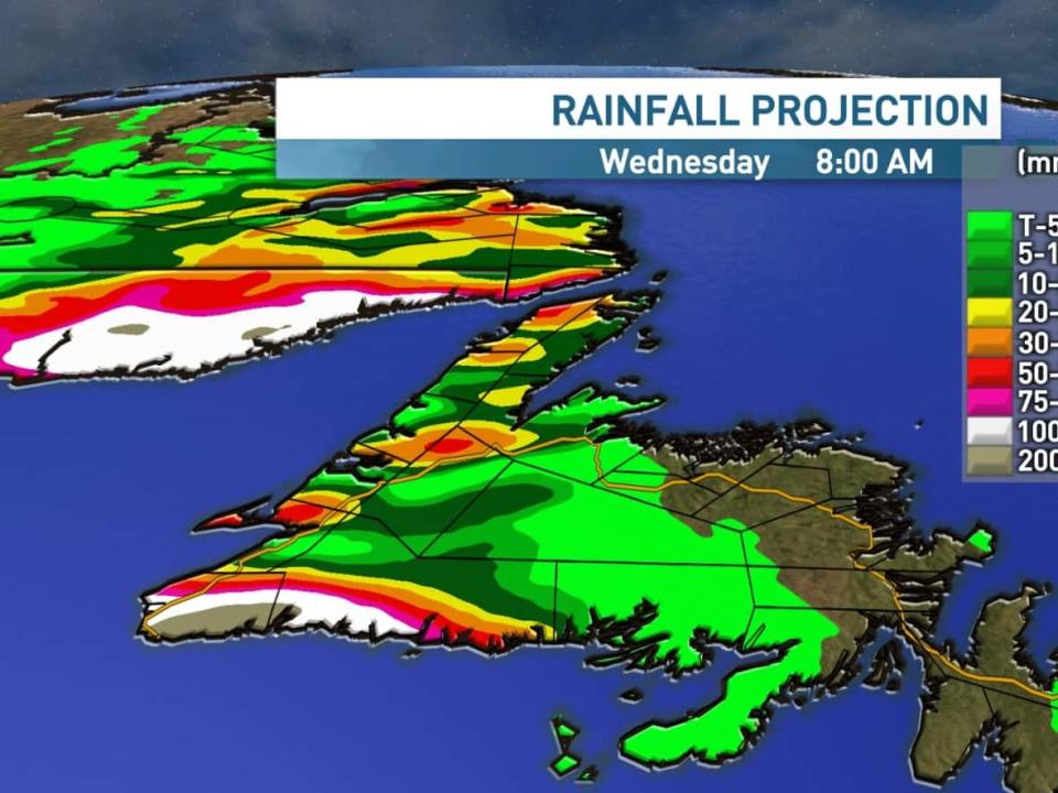
The southwestern edge of Newfoundland could see between 200 and 350 millimetres of rain over the next 36 hours in a weather event meteorologists say will likely land in the record books.
According to Justin Boudreau of the Environment Canada weather office in Gander, heavy rain will begin Tuesday morning and continue into Wednesday as a tropical trough parks over the Port aux Basques and Wreckhouse area of the island.
The system will bring 24 to 36 hours of steady rain, along with sustained winds of over 100 km/h that could gust to 150 km/h.
"Two hundred [mm] is a good low-end at this point. On average, we're seeing about 200 to maybe as high as 350, maybe even higher than that," Boudreau told CBC News on Monday. The storm could set the record for the largest rain event recorded in the province, which was 268 mm in Burgeo in 2016.
"From what I've been looking at, it's more than a one in 100-year storm type of thing."
Boudreau said the system will be almost entirely confined to the southwestern tip of Newfoundland, something he called "remarkable."
"When I look at 48-hour rainfall totals, there's a huge number down between Port aux Basques and Burgeo, and Gander and the northeast has 0.5 mm. It's something else," he said.
The system brings a high potential for washouts and flooding, according to CBC meteorologist Ashley Brauweiler.
The system is driven by an atmospheric river, according to Brauweiler, very similar to what brought intense rain and flooding to British Columbia earlier this month.
"The rain dramatically drops off for the west coast, less than 30 millimetres, except in the higher terrain where 30 to 50-plus millimetres is possible. There is a potential for some significant rainfall Tuesday night through Wednesday along the strait in southern Labrador as well, with 50-plus millimetres," she said.
Brauweiler noted that rain will be intense, with as much as 15 to 20 mm falling per hour.
'It's pretty scary stuff'
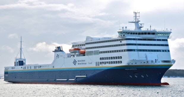
The upcoming storm has already cancelled Marine Atlantic crossings for Monday and Tuesday, with communications head Darrell Mercer saying service could be affected until Thursday if the weather lands to its full extent.
"[Captains] want to see some future forecasts before they make a decision," Mercer said.
Travellers planning to ride the crossing are asked to contact Marine Atlantic's reservation line if they'd like to make alternate arrangements.
The weather also has residents in the Port aux Basques area bracing for impact. Crews in the town of Channel-Port aux Basques were out throughout Monday checking storm drains and making sure residents are prepared, according to Mayor Brian Button.
"We have to prepare for the worst. If anything, we may get a best-case scenario maybe that we only might get 100 mm of rain," Button said. "But the forecast and the eye of all this, it's looking like it's got the potential to be something that we haven't seen in perhaps 100 years or more. It's pretty scary stuff."
Button is encouraging residents to make sure drains are cleared around private property, be prepared with enough food and water, and to contact the town in case of an emergency.

