
How 3D maps of an Alberta mountain could help predict the next flood or drought
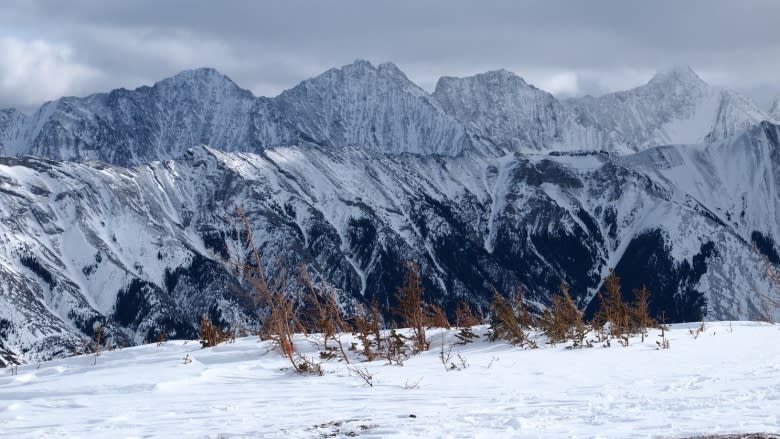
An abandoned chairlift marks what once was a developed ski run that is now a destination for scientists who hope this site will lead to better forecasting of floods, drought and other weather patterns. At 2,100 metres' elevation, Fortress Ridge in Kananaskis, Alta., boasts deep snow and an expansive view of the surrounding mountains.
"This is a good place for us to really understand how the snow is moving around and how fast it is melting on different slopes," says John Pomeroy, the director of the Centre for Hydrology at the University of Saskatchewan.
He says the research is crucial because the water from these mountains supplies cities and irrigates farmland — and is also the source of summer flooding like the 2013 melt that led to massive floods in southern Alberta that forced 100,000 people from their homes and caused an estimated $6 billion in damage.
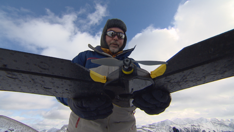
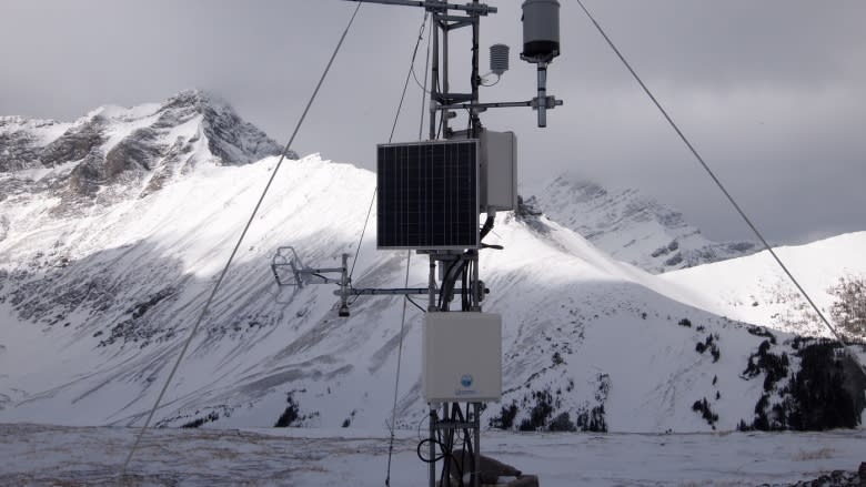
Scientific equipment, fixed into the ground, records a swath of measurements including snow depth and the intensity of the sun. But during this trip, Pomeroy and three of his colleagues have lugged up other gear aboard snowmobiles, including a mostly Styrofoam drone designed to take aerial photographs.
The team has already taken hundreds of images of this mountain and stitched them together to create a digital model that shows every snowdrift and gully.
Pomeroy calls the resulting 3D image "revolutionary" because it helps simulate what can happen with the snow under different weather scenarios, and this type of scientific modelling is a key part of a new multimillion-dollar water research project.
Forecasting for the future
Last fall, Pomeroy helped launch Global Water Futures (GWF), a research program that will run for seven years. The work is being led by the University of Saskatchewan but includes scientists from 18 different universities as well as those from federal and provincial agencies.
It's funded by more than $143 million in grants, including nearly $80 million that came from the federal government, through the Canada First Research Excellence Fund.
One of the goals of the massive undertaking is to develop new forecasting systems to provide earlier and more precise warnings about flooding and droughts.
"A lot of our models and our forecasting systems are based on the climate we have had and the water supply we have had over the last 100 years," says Pomeroy.
"That doesn't work for the future."
Pomeroy says climate change is causing extreme weather to occur more frequently, so existing systems and models aren't up to date. He also believes there is a disconnect in the current setup because weather forecasting is handled by the federal environment ministry, while flood forecasting rests with the provinces.
"We are in a bit of a different paradigm now with climate change," says Alan Pietroniro, a hydrologist with Environment and Climate Change Canada.
He said federal scientists plan to take results gleaned from the research and put it into the hands of the communities that need it.
One aim of the research is the development of a national flood forecasting system.
The challenge of climate change
While large-scale disasters such as the 2013 Alberta floods highlight the damage that can be wrought by extreme weather, officials say there are less obvious examples of the challenges being created by a shifting climate.
In Edmonton, the concern is the recent onset of intense localized rainstorms during the spring and summer, which has lead to flash flooding in older areas of the city, where there are no stormwater run-off ponds.
"Those systems do not have the same protection," says Chris Ward, the city's manager of drainage, because standards were different when those areas were constructed.
While drainage systems are being updated, Ward says it's unclear just what kind of storm they'll need to be able to withstand in the future.
"If we just build them to the same standards ... without thinking about the changing weather patterns that we are seeing, then the systems won't last."
Ward says research is critical because municipalities need to know what to prepare for.
"We can see what used to happen is not necessarily the best predictor of what will happen."
That mantra drives Pomeroy's work and the research going forward. If forecasting systems aren't updated, he believes the risk to communities and industry will increase.
"Canada has a chance now with this to get a little bit ahead of the ball," he says.
"Our ultimate goal at the end of seven years is to leave Canada a more sustainable country."
