
Heavy rainfall washes out roads around Ottawa
Water levels in areas south of Ottawa are now so high that some residents can't get to their cottages and homes.
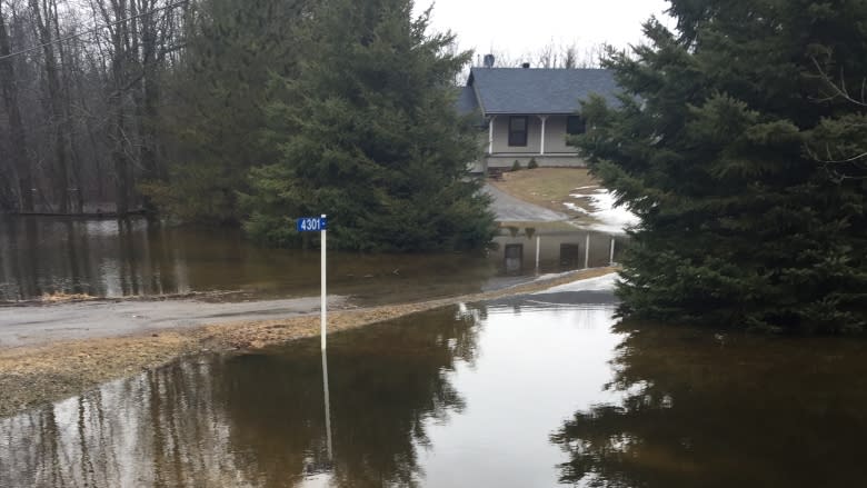
On Friday, the only road leading into the tiny community of Hilly Lane was completely under water. Residents with off-road style vehicles were still able to navigate the washed out lane into the community. Most others had to park their cars on the side of Rideau River Road and use hip waders to reach their homes and cottages.
The community was also hit by flooding in 2011 and 2014.
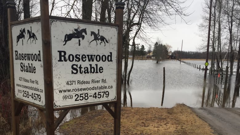
Just down the road from Hilly Lane, the long driveway leading into Rosewood Stable is also under water. The owner of the stable, Marie Bastien, said there are ten horses at the stable.
"We normally get some flooding but not to this degree," she said.
Bastien said she is still able to get in and out of the stable in her large pick-up truck, but for most others the driveway is impassible. She says it's fortunate that she doesn't teach riding lessons on the weekend.
"If it keeps raining I'll be concerned," she added.
The latest statement from the Rideau Valley Conservation Authority says above normal rainfall is causing high water throughout the Rideau Watershed. Water levels this high were last seen in 2014, according to the agency.
It adds that the worst flooding is in North Grenville and rural Ottawa near the confluence of Kemptville Creek and the Rideau River.
Plenty of farmer's fields under water. On Friday, Chris Sargent feared water from a farmer's field was about to wash out a section of Rideau Valley Drive North, about two-and-a-half kilometres south of Manotick.
"To me that was an emergency," he said.
The retired public servant says the farmer's field next to the road was dry on Thursday. Now, it looks like a lake. He said the road was in danger of being washed out because a culvert stopped draining water from the field.
"The force of the water pushed the culvert right up into the air so one of the culvert was touching the water, it was above the water level. So then the road acts as a dam and it was just daming up."
Sargent, who has lived in the area for twenty years, said he called the city and was told it was monitoring the situation. He suggested it needed more than monitoring so a crew came and pushed the culvert back down so the water could flow through it again.
"I've never seen this, I've never seen anything like this," he said.
Some roads in Prescott and Russell closed
Meanwhile, residents and officials are also reporting rising water levels east of Ottawa. County Road 9 north of St. Isidore washed out after this week's rain, and a detour is in place for drivers.
Several roads in the area are closed due to flooding on the South Nation River, said Jeremie Bouchard, public works engineer for the United Counties of Prescott-Russell.
"There is a possibility that the water [leve] will increase, depending on how fast rivers and small streams drain into the area further west of the river," Bouchard told Radio-Canada on Saturday, speaking in French.
Officials from Stormont, Dundas and Glengary are also monitoring water levels in the area and are asking residents to use caution.
