Double blizzard: Ontario, British Columbia slammed in back-to-back storms

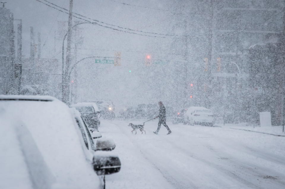
After a relatively calm and mild start to 2019, Western Canada has now been hit with significant snowfall. While residents in British Columbia continue to dig out from Sunday’s snow, it keeps coming down in the region.
“We continue to see these storms coming through here, which is very unusual,” Brett Anderson, senior meteorologist with AccuWeather told Yahoo News Canada. “I can’t remember in my 30 years of forecasting ever seeing one storm after another coming through this region.”
According to The Weather Network, snow accumulation amounts in the South Coast have tripled for Monday into Tuesday, with up to 15 cm expected in Vancouver areas, Metro and the suburbs, and up to 25 cm for Victoria. Some regions, like Nanaimo and the central parts of Vancouver Island, will see up to 40 cm of accumulating snow.
Had to trudge for 45 mins to get to a bus stop but the @BCTransit operators are doing a terrific job this morning! #yyjtraffic #bcstorm pic.twitter.com/HPHimxhj2S
— Rob Freeman (@robfreemanYYJ) February 12, 2019
According to Environment Canada, the South Coast of B.C. is expected to see up to 25 cm of snow on Tuesday that will gradually taper off in the evening.
But this won’t be the end of the snowfall for Western Canada this week, with another storm expected pummel the region. According to Nadine Hinds-Powell, meteorologist with The Weather Network, this will mostly be a snowfall event with milder conditions, with the possibility of some rain mixed in along the coastal areas of B.C.
“That one is going to be a warmer storm late Thursday, mostly Thursday night to Friday,” Anderson said. “Right now, I figure it’s probably a mix of snow and rain in Vancouver…a little early to tell at this point, but it’s certainly possible they could see more accumulating snow there.”
In addition to snowfall, it’s really the temperatures that are the unusual part of this week’s forecast for the province. Normal highs for Vancouver are about 5 C but temperatures have been hovering around freezing instead.
According to Hinds-Powell, these colder-than normal-temperatures in the region is one of the reasons why there has been so much snow over the last few days.
But Western Canada isn’t the only area preparing for snow this week.
Mixed precipitation is advancing north across the Niagara Peninsula, which shows up nicely using the Correlation Coefficient product. Mixed precipitation types cause the CC to drop below 1 (yellow and red colors), because the targets are different shapes and sizes. #onstorm pic.twitter.com/cUTh1x27bh
— Michael Carter ❄️ (@MichaelCarterWx) February 12, 2019
‘A big mess’ in Toronto
Toronto is seeing a “mess” of snow and sleet, Anderson describes. This is only the third time in the past 20 years that the Toronto District School Board has closed all of its schools due to a snow storm.
According to Hinds-Powell, the early afternoon hours are expected to be a bit calmer than the morning but this “challenging” storm has already caused dangerous driving conditions for Tuesday morning commuters.
But don’t be fooled, a second blizzard with strong winds is expected to hit Tuesday evening and into Wednesday morning, dropping up to 10 cm in Toronto overnight. This will make for another resulting slippery commute around the city.
“There may even be a little bit of freezing rain as well, although I think not a lot, worst of the freezing rain is probably going to be down towards Hamilton and London,” Anderson said.
Lake Ontario is angry! Massive swells and this video is not doing it justice of the #seiche, intense winds, stinging ice pellets/freezing spray and snow! @weathernetwork #onstorm #BurlOn pic.twitter.com/ZMv6m9TDUw
— Chris Murphy TWN (@MurphTWN) February 12, 2019
According to The Weather Network, strong winds will also be a contributing factor with blowing and drifting snow across the region, particularly in more exposed areas.
If you’re in the Niagara region, Anderson warns that there is the potential for some more sustained periods of freezing rain that could result in power outages.
According to Environment Canada, the city of Toronto will see up to 25 cm of snow and ice pellets, possible freezing rain, and strong wind gusts at 80km/h. Father south, the Windsor area could see up to 15mm of freezing rain, leading to significant ice buildup. The snow should be easing up by Wednesday, with only a few centimetres expected in the morning.
This is quite a long ranging storm that will also bring 30 to 40 cm of snow to the Ottawa and Montreal areas Tuesday afternoon into Wednesday, with a risk for localized power outages.
“They may mix with a little sleet maybe but mostly a snow storm it looks like for Ottawa and Montreal,” Anderson said.

