
Big storm to hit B.C. coast overnight
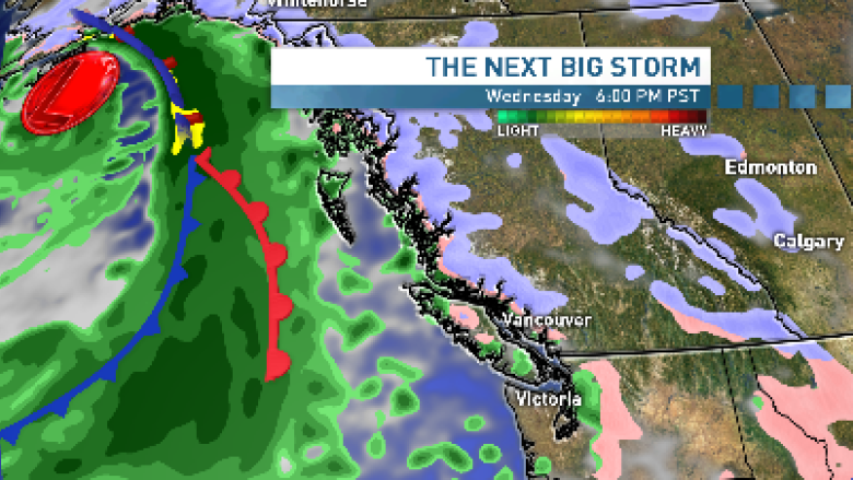
Environment Canada has extended weather warnings along the B.C. coast as a wicked storm approaches Wednesday night.
The North and Central coast are expected to be hit by the storm late Wednesday night, with strong southeast winds reaching up to 100 km/h over Haida Gwaii.
The storm should hit the rest of coastal and southern B.C. by Thursday morning.
The storm will bring heavy rain and strong winds. Precipitation may start off as snow but will likely change over to rain for most of the mountains.
Special weather statements covered 23 regions of B.C. as of Wednesday afternoon, including Prince George, Whistler, Metro Vancouver, and most of the Southern Interior.
In parts of the Interior, Environment Canada warns of a cold front Thursday with strong gusts up to 80 km/h, and snow in the Kootenay and Columbia regions.
Stay tuned to Environment Canada for the latest watches and warnings as we get closer to the storm.
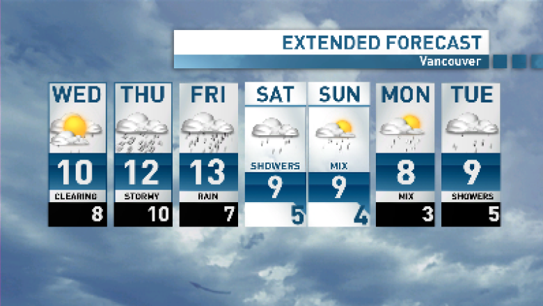
There is still some uncertainty as far as how long this storm system will hang around — but there's a good chance rain will continue for Friday.
A cold front that slid through Vancouver late Tuesday evening left fresh snow on the mountains, Whistler and the mountain passes.
