
Canadian weather will 'take a breather' on Christmas

Hoping for a white Christmas next week? Or maybe an easy, snow-free commute over the holidays? As you might expect, how harsh the winter weather will be for the rest of the year really depends on where you are in Canada.
According to Doug Gillham, meteorologist at The Weather Network, southern Alberta has the best shot at a white Christmas, while Atlantic Canada should brace for above-normal temperatures and a downpour of rain.
Here’s what you can expect across the country until the end of 2018:
Ontario & Quebec
Much of Ontario and Quebec are likely going to experience a bit of a break from active weather patterns and frigid temperatures.
“I’ve called it the Grinch that’s going to steal a white Christmas from millions,” Gillham said.
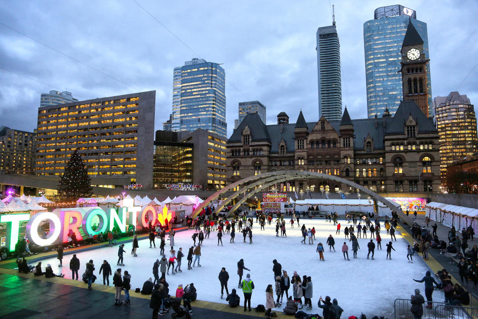
In the days leading up to Christmas Day, southern Ontario, eastern Ontario and southern Quebec are being hit with widespread rain through to Saturday morning. But over the weekend, some areas are going to see a blanket of snow.
“In downtown Toronto the best we can hope for is a dusting, that’s not going to give us a white Christmas,” Gillham said. “The further north you go, away from the lakes…into eastern Ontario could get a nice coating of snow Saturday morning, after getting soaked.”
Parts of northeastern Ontario, east of Lake Superior and north of North Bay will see significant snow that will “certainly” impact travel.
“We’re not going to repeat the frigid weather, it’s going to be a lot easier for pre-Christmas travel especially in the [Greater Toronto Area],” Gillham said.
Around Boxing Day or December 27, southern Ontario is expected to see a “large moisture-laden, high-impact storm.” But meteorologists are still waiting on details about what combination of rain, ice and snow will be seen.
“Then we’ll have to watch to see if we get a second storm later on before New Year’s,” Gillham said. “We could see the winter weather a little bit further south with that storm.”
Atlantic Canada
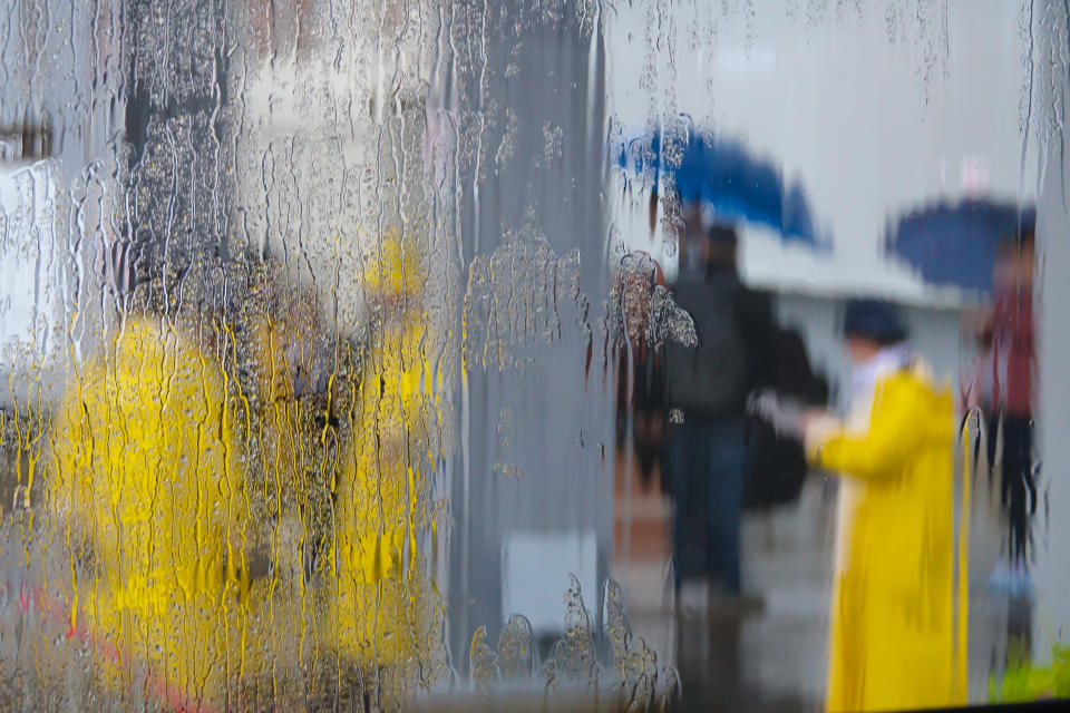
The rain that’s hitting much of Ontario and Quebec will be soaking Atlantic Canada as well.
“The rain is going to extend all the way into central Labrador,” Gillham said. “We’re going to see rain up until Labrador City, Happy Valley-Goose Bay.”
According to the meteorologist, the Maritimes could see 30 to 50-plus millimetres of rain on top of the existing snow, which sits at around 30cm in some northern areas. This level of water, paired with possible record-breaking high temperatures, has prompted flood concerns for the region.
“Double digits in some spots…to potentially mid-teens with rapid snow melt gives a flood threat for Friday and Saturday in Atlantic Canada,” Gillham said.

Central Canada
Unlike Atlantic Canada, Central Canada will definitely be one of the colder areas in the country at the end of 2018. There are a couple shots of cold weather heading into the region head into Christmas, building from Alberta into northern Ontario and attempting to spread south as we move into New Year’s Eve.
Southern Alberta has the best chance of seeing snow on Christmas morning, while Calgary also has a chance to see snow on Christmas Eve, into Christmas Day.
This cold air will hit as a conflicting wave of warm air surges north from the Southern and Eastern U.S., attempting to cross the border. This is expected to cause a more active storm pattern between Boxing Day and New Year’s Eve.
“At least one, potentially two, high-impact storms tracking from the Southern U.S. towards the Great Lakes region, so on the dividing line between the two air masses,” Gillham explained.
British Columbia
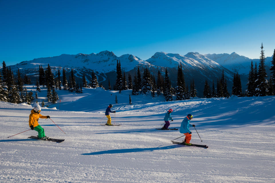
Just west of the active weather pattern in Central Canada, skiers and snowboarders should love the weather in B.C. Over the past ten days, the mountain region has seen metres of snow and it looks like it’s going to keep coming.
This active storm pattern is expected to continue into early next week for the south coast of B.C., while this stormy pattern starts to relax after Christmas Day.
“The last week it’s been relentless. Hardly a break at all…some of the systems have just blended into each other,” Gillham said. “When we get into next week you get breaks, a couple days in between systems and then you get a fresh dump of snow, and then another break.”
While the mountains will continue to see snow, Vancouver and Victoria, the lower elevation areas, will not be getting any significant snowfall.
This comes after a wicked wind storm hit the province on Thursday, with wind gusts up to 100 km/h in the Lower Mainland. According to Environment Canada, the region could see up to 50mm of rain on Friday alone.
Check-in on the winter forecast
As we begin the the winter season in earnest, Gillham is confident in the winter forecast The Weather Network predicted earlier this month.
According to Gillham, there’s a changeable pattern for the rest of 2018, but we haven’t locked into a winter pattern yet. The meteorologist predicts more winter weather is coming soon, likely in January and more so in February.
“I would have been more alarmed if we had a cold December because it’s rare to run the table on the season,” Gillham said. “The two years in history that were the strongest matches, what we call analogue years, had very mild Decembers and then the pattern flipped for January and especially February.”
