
City of Calgary enters state of local emergency in response to heavy rainfall
For Tuesday's developments, see:
The City of Calgary has announced a state of local emergency in response to heavy rainfall.
The special order came into effect at 3:59 p.m. on Monday.
In a news conference, Calgary Mayor Jyoti Gondek said the special order allows police and fire departments to go door-to-door in the event of an evacuation, gives the city's water services team access to property to protect critical infrastructure, and allows the city to quickly secure supplies if needed.
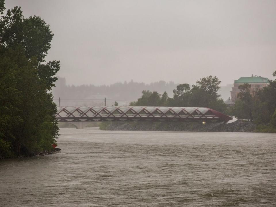
In a warning issued Monday morning by Environment Canada, the agency said prolonged and significant rainfall events will bring 75 to 125 mm of rain by Wednesday morning in the Calgary region. In some areas, rainfall totals of 150 mm or more are possible, the agency said.
Calgary saw 26.1 mm of rain on Monday.
Gondek stressed that the declaration of the order has been made as a precautionary measure, and that rainfall projections and water levels remain lower than in 2013, when downtown and other parts of the city were flooded.
Chief Susan Henry with the Calgary Emergency Management Agency said any potential evacuations will depend on how weather conditions develop over the next couple of days.
Bowness and Sunnyside, which border the Bow River, are the Calgary neighbourhoods most at risk of high flows, said Henry.
Areas most at risk of flooding
This map by the Calgary Emergency Management Agency shows the areas at most risk of flooding
She added that river conditions will continue to be monitored, with peak water flow on the Bow River expected Wednesday evening and the highest water levels expected in Calgary on Thursday.
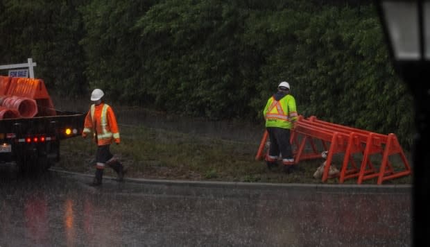
Due to the construction of a temporary berm, a portion of Memorial Drive will be closed to traffic starting on Monday at midnight, between 10th Street N.W. and Edmonton Trail N.E.
Henry urged Calgarians to exercise caution as forecasts and river conditions will continue to change quickly.
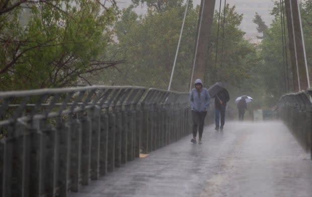
Assistant deputy chief Brian McAsey with the Calgary Fire Department said it is unsafe for Calgarians to be on either the Bow or Elbow rivers, or near riverbanks.
"Right now, the water is extremely turbid, so [it's] not very clear, we can't see into it. It's also extremely swollen, [on] both those riverbanks. And so that means the riverbank is not a safe place for you."
Francois Bouchard with the city's water resources department said preparatory measures, such as lowering water levels in the Glenmore Reservoir, have been put in place since the city began tracking the weather system last week.
Bouchard added that while both the Elbow and Bow rivers are expected to see higher flow levels, the Bow River poses a greater flood risk to the city. Current projections show more rainfall over its catchment area.
If Calgarians choose to sandbag their property, the city advises building a wall about 30 centimetres high and six metres long, which requires roughly 100 sandbags. Contact your local landscaping or home building supply company for sandbag material.
The city has also released a map showing areas most at risk of being impacted by flooding.
'Tense time' for Albertans
In a news conference in Edmonton on Monday, Lisa Jackson, executive director of environmental emergency management for Alberta Environment and Parks, said experts are crunching the data to figure out who could be affected and who is at risk across the province.
"We're watching a significant rain event come in. We've seen it on radar already, and it's starting to move into the eastern slopes," Jackson said.
She said a complicating factor is an above-average snowpack at higher elevations.
One area that Jackson said the province is watching carefully is upstream of High River.
"We're just working with the communities to help understand what those impacts would be if it results in those levels," she said.
The Alberta River Forecast Centre issued a flood warning for an area of Foothills County late Monday. It includes the Highwood River from the Town of High River to the Bow River confluence.
Environment and Parks has also set up its department co-ordination centre to help manage the situation as it develops.
"I know this is a tense time for many Albertans — this is especially true for communities that were at the centre of the devastating 2013 floods," Jason Nixon, minister of environment and parks, told reporters Monday.
"While I realize that having a flood warning or a flood watch in place will be especially difficult for folks in Calgary, High River, Canmore and other communities flooded in 2013, please know that Alberta is better prepared than ever for high river events."
He said that since 2020, Alberta has added more than 1,500 kilometres of new and updated flood mapping, which is more than the previous 30 years combined.
Nixon said he's been speaking with civic leaders in Sundre, located about 110 kilometres northwest of Calgary, and Mountain View County, as well as other rural municipal leaders. Provincial officials have also been talking to the City of Calgary and municipal associations.
"While municipal governments typically respond to flooding and other local emergencies through the Alberta Emergency Management Agency, the Government of Alberta stands ready to assist with the response, if needed," Nixon said.
He encouraged Albertans to co-operate with local officials should there be a need to evacuate any areas in the province. He also recommended people download the province's river app and Alberta's emergency alert app to keep informed on developments.
"A theme throughout every emergency Alberta has ever faced is this: We are in it together. We will work together. We are resilient people and we stand by our neighbours."
On Monday afternoon, the Town of Canmore, located about 100 kilometres west of Calgary, said it has activated its emergency co-ordination centre and is monitoring flow levels in Cougar Creek and the Bow River.
It has also prepared sandbags for flood protection, which are available for pickup at the public works building parking lot, located at 100 Glacier Drive.
A flood warning issued by Alberta Environment for the Bow River in the Town of Banff was downgraded to a flood watch on Monday afternoon, reflecting lower than forecasted rainfall for the area. Emergency personnel have deployed temporary dams near Birch Avenue and the Banff Recreation Grounds.
