
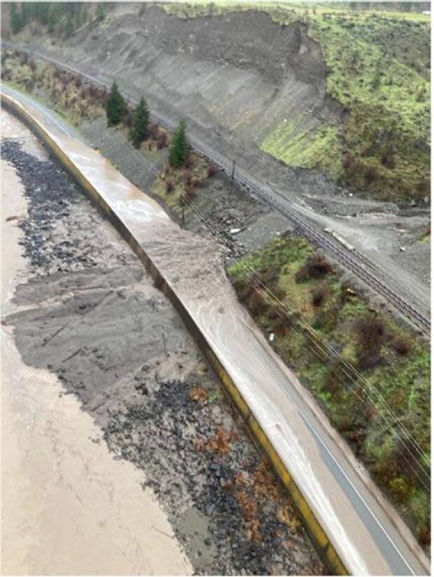
Destroyed section of Hwy 1 was deemed 'high risk' of landslide in September post-wildfire report
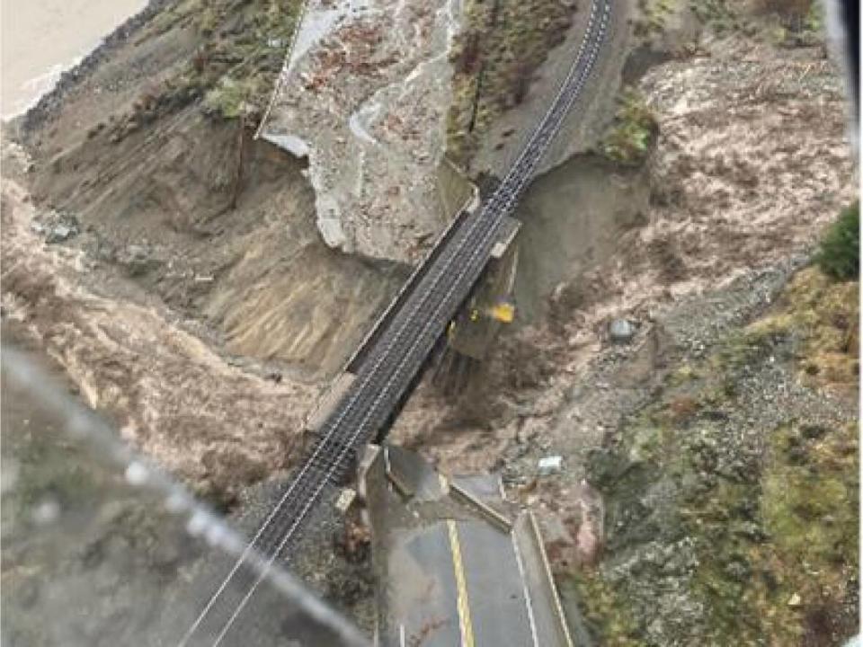
A section of the Trans-Canada Highway destroyed by a mudslide east of Lytton, B.C., last week was identified months ago as being at risk of landslides and flooding following a devastating wildfire in the area this summer.
The area at Tank Hill was just one of at least a dozen "high risk" or "high hazard" locations identified among 54 initial post-wildfire risk assessments compiled by the Ministry of Forests, Lands and Natural Resources Operations in recent months. The ministry released the initial assessments that identify high risk to CBC News.
Entire neighbourhoods, highways and recreation areas are among the sites identified at risk of experiencing devastating landslides, flood, debris flows and water quality issues.
The assessments are raising alarms about the effects of future disasters in the wake of last week's unprecedented rainfall and the summer's wildfire season — the third most destructive in B.C.'s history.

Lytton wildfire highlights risk
Fire-damaged landscapes hit by intense rainstorms or snow melt create a threat of landslides, floods and debris.
Very hot fires form a hard, water-repellent crust on the soil that can't absorb water, which just runs off. Fires also remove vegetation that protects against erosion.
Less than four months ago, during a spell of record-breaking high temperatures, a wildfire consumed the town of Lytton and swept across surrounding hillsides, leaving burned scrub and heat-hardened soil behind.
On Sept. 17, the B.C. Wildfire Service and the Ministry of Forests released an initial assessment of the risks and hazards created by the Lytton fire.
"Recent rainfalls in mid-August initiated erosional sedimentation events in numerous small watersheds leading down to the [Trans-Canada] highway," wrote Tim Gilles, an independent geotechnical engineer.
The report also identified lighter flooding and debris flows in and around Nicomen Indian Band land east of Lytton, and rated the risk to homes and infrastructure as "high."
Work to minimize the impact of a slide had already begun, according to B.C.'s Ministry of Transportation.
In a statement to CBC News, the ministry said it had "completed temporary mitigation work along the corridor and had mitigated impacts from previous rainfalls (ditching, culvert clearing) while longer-term options/solutions were being assessed."
"Tank Hill was one of the areas that the ministry was watching as a result of the wildfires. It is important to note that this was a historic rainfall event."
Ken Gillis, board chair of the Thompson-Nicola Regional District, told CBC News the region was informed of the assessment. He said the mitigation work undertaken was as much as could have been reasonably expected in such a relatively short time.
High-risk sites
According to the ministry, a "high hazard" designation indicates a high probability of a hazardous event such as a flood, landslide or debris flow. "High risk" indicates that such a hazard is likely to affect homes, roads or facilities like recreation sites.
Among the most concerning areas identified by the ministry are parts of the large expanse burned by the White Rock Lake fire this summer.
The initial assessment warns of a high risk of landslides and moderate risk of flooding to dozens of homes on both sides of Monte Lake, along with area highways.
In August, more than 250 homes were evacuated and around 30 structures in the Monte Lake area were destroyed by the fire, one of the biggest of the past fire season.
It also destroyed almost 80 homes in neighbourhoods along the northwestern shore of Okanagan Lake. Scorched hillsides above Westside Road and the Killiney Beach area now threaten to unleash floods and landslides through neighbourhoods that survived the summer flames, according to the White Rock Lake assessment.
Risk assessments are ongoing, but other areas deemed high risk after an initial assessment include:
Along the Trans-Canada Highway near Siska Creek and Saw Creek, south of Lytton, which is at high risk of flooding and debris flows.
The north slope of Bill Nye Mountain near Cranbrook, which is at risk of debris floods that could threaten a half-dozen homes.
The Gladstone and Van Houten recreation sites near Fauquier, around 100 kilometres east of Kelowna, which are at high risk of debris flow.
More assessments have yet to be completed, including a report of the impact of the Sparks Lake fire, the summer's largest blaze.
