
East Coast storm risk hinges on 4,000 km front from the Avalon to Cancun

A boundary draped across the length of North America could have a significant effect on Eastern Canada’s weather heading into next week, with another forming not far behind.
This front, which extends from Newfoundland’s Conception Bay to the tip of Mexico’s Yucatan Peninsula, will spin up a storm that could threaten Atlantic Canada early next week.
Another boundary of similar stature could develop farther west and bring unsettled weather to Ontario, Quebec, and the Atlantic provinces heading into the latter half of next week.
MUST SEE: Massive filament swirls into a 'polar vortex' on the Sun, wowing scientists
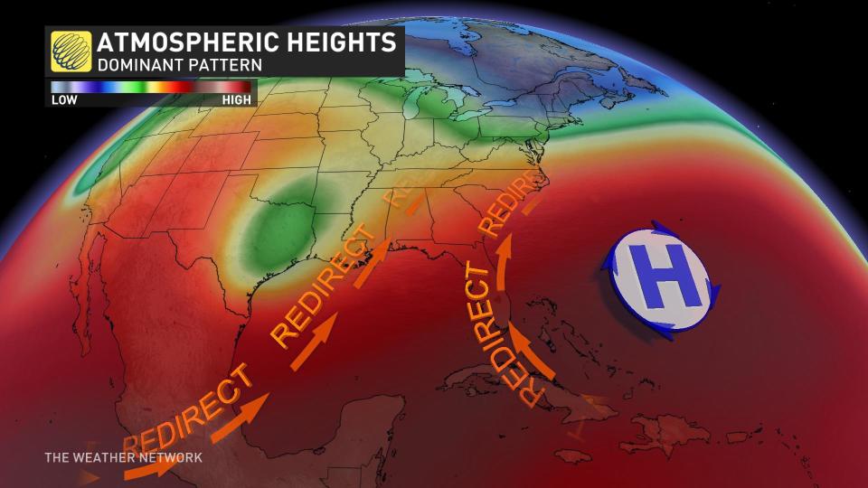
Our atmosphere is an interconnected wonder, touching every remote outpost and bustling city on our gorgeous blue marble.

One only needs to look at the boundary stretching 4,000 km from the rocky shores of the Avalon Peninsula to the steamy beaches of Cancun, Mexico, to admire how two vastly different and distant spots can share a common thread in the skies above.
This lengthy boundary will serve as the focus for the next storm aiming for the East Coast. A messy low-pressure system will develop along this boundary down in the southeastern United States.
That low will continue north along the Atlantic seaboard, bringing it uncomfortably close to the East Coast early next week.
Current weather models show the storm tracking just off the coast of the Maritimes and Newfoundland.
The ultimate track of this low means everything for the Atlantic provinces’ weather early next week. If the low nudges slightly to the west, we could see snow in the Maritimes and a mix of precipitation in Newfoundland.
Watch the video below to see how this coastal system could play out, and check back through the weekend as details become clearer on this system heading toward Atlantic Canada.
Later in the week, we’ll have to watch another boundary over central sections of Canada and the U.S. for another round of stormy weather.
DON’T MISS: This could be the first year the Rideau Canal Skateway doesn't open
Models show a Texas low developing along this boundary and moving into the eastern half of Canada by the end of the week.
It’s far too early to know specific details about this system, but this setup would be favourable for a large system that could drag plenty of precipitation north of the border into Ontario, Quebec, and Atlantic Canada.
Stay tuned to The Weather Network for the latest on conditions across Canada.
