
Eastern Newfoundland under winter storm warning with a possible 40 cm of snow on the way

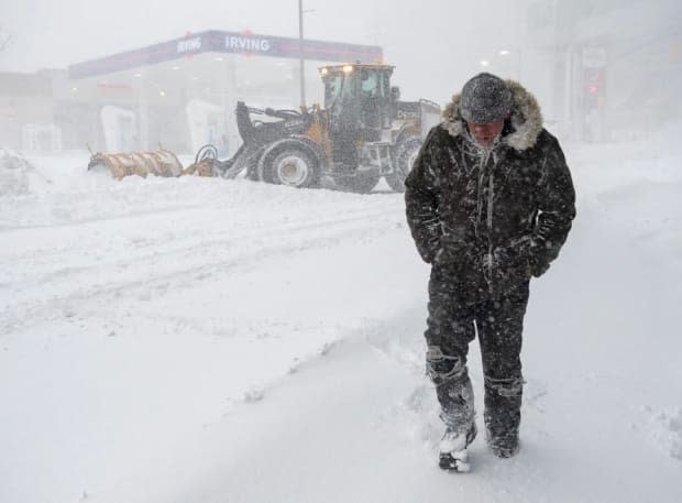
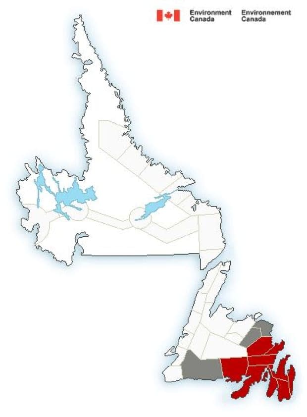
A swath of winter storm warnings are in effect for most of eastern Newfoundland on Monday.
Environment Canada meteorologist Justin Boudreau said Monday about 30 to 40 centimetres of snow could fall over the northwest Avalon Peninsula, Clarenville, Bonavista Peninsula and Burin Peninsula areas, beginning overnight and continuing until Wednesday.
"It will generally start with snow overnight tonight for most areas and that will continue through most of the day Tuesday," said Boudreau.
"For the Avalon Peninsula, that will change over to kind of a mixture of ice pellets for most areas — ice pellets and snow — but then in the southeast it'll probably be more of a mixture of freezing rain and rain."
Boudreau said the Burin Peninsula and southern Avalon Peninsula will likely see the weather system first, around midnight.
The nasty weather is expected to reach the St. John's area between 3 a.m. and 4 a.m. Tuesday.
Wind speeds are expected to start off easterly between 60 and 70 km/h before switching to northeasterly.
"We're looking at the maximum gusts for most of the areas to be around 80 km/h and for the southern Avalon, where the winds are northeasterly, they do get a little bit of some local effects there so they'll probably get up to 100 km/h in some of those areas," said Boudreau.
"Visibility is going to be pretty poor for most of the areas."
Areas seeing the switch to ice pellets won't be out of the storm for too long.
Boudreau said the weather will deteriorate again Tuesday night as the ice pellets switch back to snow.
"Winds might not be quite as strong. It might be more like gusting to 70 km/h all night Tuesday. That's still enough to cause blowing snow and poor visibility," he said.
The weather system is expected to push out around noon on Wednesday.
Rethinking Valentine's Day
With the messy weather set to making driving conditions deplorable, Environment Canada is suggesting postponing non-essential travel until conditions improve, which may impact Valentine's Day plans for some.
Kristýna Adamová, owner of Newfoundland Floral Design, was busy preparing orders on Monday so customers could pick up their flowers ahead of the storm.
"I would say it's the busiest time of year, definitely, for our industry. Everybody is working really, really hard, and it's kind of a last-minute purchase," Adamová said Monday.
A snowstorm disrupted business on Valentine's Day last year as well.
Adamová said she's ready for her customers after learning a lesson a year ago.
"We are prepared, so I'm calm. I'm happy, it's going to be fine," she said.
"We're open later than usual. I would say 7 or 8 p.m. We're open Valentine's."
