
What goes into closing a busy highway? Inside the 2018 Trans-Canada Highway closure
Officials rushed to secure hundreds of pylons and road signs, as the St. John River lapped the highway near Jemseg last spring, threatening a crucial transportation link.
The closure of the Trans-Canada Highway between Oromocto and River Glade, now in place for a second year in a row, has officials with the Department of Transportation and Infrastructure discussing how to mitigate flooding around the busy stretch of road.
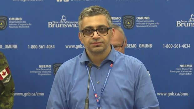
While it's too early to say what those plans might look like, the Department of Transportation's director of operations acknowledged that a flood large enough to close the highway is no longer "unprecedented."
"When this event happened last year, we were under the impression that this was a historical event," Ahmed Dassouki said.
"Two years in a row, the historical event happened."
The government has warned the highway could be shut down for several days, forcing drivers to take a 90-kilometre detour.
Hundreds of pages of records from last year's spring flood reveal what goes into shutting down a busy highway, from finding enough signs to deliberating, painstakingly, over what the signs should say and where they should be placed.
The records, obtained through right to information legislation, show how officials with Transportation Department and MRDC Operations Corp., the private company that manages that part of the highway, prepared in the days and hours leading up to the 2018 closure.
Traffic collisions and 'abusive people'
Before the decision was made to close the highway, MRDC prepared an "Emergency Operational Plan" to deal with flooding.
It laid out the route for a detour — the same route in place this year — and who would be responsible for doing what.
It warned that such a detour could pose risks to employees, including "traffic collisions" and "abusive persons suffering from event-related stress and anxiety."

For the people responsible for keeping the highway safe, the crucial water level was 6.8 metres.
"Based on our 2008 survey data, we estimate that floodwaters could enter the passing lane area when the water elevation at Jemseg reaches 6.8 metres," former MRDC general manager Norman Clouston wrote in an email to Transportation and Infrastructure staff last year.
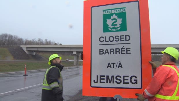
On May 2, the day before the call was made to close the highway, DTI staff started collecting signs and pylons.
Gateway Operations, another private company that manages Route 1, emailed a list of the signs they could lend, including 12 "Water over road" signs and 100 orange candlesticks with weighted bases.
But collecting enough signs was only half the battle.
What should they say?
They also had to determine the best locations to place the signs, so people would have enough warning, and to figure out the exact messaging.
The messages had to be relayed in both French and English, and they had to be succinct to fit on the electronic variable message boards.
They needed to figure out those messages as soon as possible, giving enough warning so signs could be put up at borders in Quebec, Maine, Prince Edward Island and Nova Scotia.
Some signs initially displayed "Expect delays," but after some discussion, were changed to "Detour in place."
The official call was made just after noon last May 3, with plans to shut down the highway at 7 o'clock that night.
The government told the public at its daily 2 p.m. EMO press briefing.
If asked why the highway wasn't built higher, Dassouki was instructed to say the water levels were "unprecedented" and the focus was on "public safety and restoring transportation links as quickly as possible."
Just before the decision was announced to the public, staff were told to gather information to send to then-minister Bill Fraser on whether sandbagging along the highway was a possibility.
Clouston wrote that MRDC looked at "several options of both water retention/prevention and debris control" along Grand Lake Meadows, so the highway wouldn't have to close.
But sandbagging wasn't practical.
"If sandbagging efforts were deployed, we would need to create a wall or canal where the road would be lower than the surrounding water level and try to pump," Clouston wrote.
"It was our opinion that we could not manage the inflow to maintain a dry road surface."
Ultimately, the risk of drivers hydroplaning was too great, he said.
"If a situation evolved that a vehicle left the 'travelled' path, it could enter water depths that are significant," Clouston wrote.
"Then recovery would be needed and access would be very limited … the risk is just too [great] to jeopardize public safety."
Public patience 'getting thin'
On the second full day of the closure, DTI staff shared photos of water spilling over both westbound lanes of traffic and over the driving lane eastbound.
"Looks like the right call was made on Route 2," one staff member wrote.
But the closure was taking its toll.
At a May 6 meeting, a supervisor noted that Route 7 had "begun to have rapid deterioration due to the heavy truck traffic."

On top of that, the public's patience was "getting thin," minutes from another meeting showed.
As the water began to subside, the recovery began. Crews had to remove debris from the highway and assess the damage, and to determine what effect stranded moose might have on plans to reopen.
When MRDC staff inspected the road after the flood, they didn't find any stability issues. But they found erosion to the shoulder and foreslope areas in both east and westbound lanes, broken guardrails and wood debris.
MRDC preparing for long cleanup
The highway reopened to one lane of traffic each way on May 11, more than a week after the closure began.
But the damage to the highway wouldn't be fully repaired for three and a half months.
Al Giberson is preparing for the same kind of cleanup this year.
"It doesn't look to be as bad but we really won't know until the water recedes completely," said Giberson, who replaced Clouston as MRDC's general manager.
Both Giberson and Dassouki acknowledged things were going smoothly with the closure this year. They know where to find the signs and exactly what they should say.
What they don't know is whether they'll be doing the same thing again next year.
"Nobody controls the weather," Giberson said. "Nobody controls the river."
