
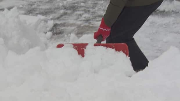
Heavy snow to start the weekend, with more potentially to follow on Monday
Winter may be over, but the snow certainly isn't.
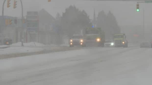
Much of Newfoundland is bracing for at least one more sizeable drop over the weekend, with special weather statements and freezing rain warnings warnings in effect starting Friday evening.
"It's just going to be a dirty day no matter where you are," Mike Vandenberg, a meteorologist with Environment Canada's Gander weather office, told CBC Radio's St. John's Morning Show on Friday.
On the east coast, Vandenberg said, the Bonavista and Clarenville region could see around 30 centimetres of snow, beginning overnight Friday and throughout Saturday. Winds are expected to gust up to 70 km/h.
"It's not going to be an insignificant March storm, that's for sure," he said.
They're going to Alert Level 2 but I think everybody is going to be self-isolating by default. - Mike Vandenberg
On the Burin and Avalon peninsulas, Vandenberg said, things are harder to call. The weather will depend on where the line of the weather system sets up, and there isn't a clear divide between the areas of snow, rain and ice pellets on the way, he said.
The Burin and southern Avalon regions are expected to receive 10 to 20 millimetres of rain Friday evening, before transitioning to freezing rain and ice pellets shortly after midnight and turning into snow around noon Saturday. Winds can reach 60 to 70 km/h gusts.
The St. John's metro area is among the toughest to predict right now, said Vandenberg. Rain totals are expected to be small Friday evening before turning to freezing rain shortly after midnight, and then to snow or ice pellets overnight.
Snow, at times heavy, will persist through Saturday. with about 15 to 25 centimetres expected. Winds are expected to gust up to 70 km/h.
Winter storm warnings are in effect for parts of central Newfoundland and the south coast of the island, as well as a winter storm watch for parts of the west coast including Deer Lake, Stephenville and Corner Brook. The west coast could see around five centimetres of snow, winds gusting up to 60 km/h.
'This winter has been bizarre'
To prepare for the conditions, Bay of Islands Search and Rescue has put its members on a heightened alert this weekend in case of emergency.
Garry MacKenzie said he's "in awe" of the mixed bag forecast for this weekend, and he expects a "wintry mess" to wrap up an already unusual season.
"Whether it's just regular snowmobiling on trails, we're concerned about the rocks and stumps and things like that being exposed. This wind even has enough potential to knock down some trees across trails," MacKenzie said.
"The ice conditions are deteriorating incredibly quickly and they really were never that great at any point in time this season — it's no secret this winter has been bizarre, warm. There hasn't been as much snow as we're used to."
With fresh snowfall on top of melting snow, paired with high winds, MacKenzie said he's concerned about the risk of avalanches on the west coast.
Given it's likely the last wintry getaway weekend of the season, MacKenzie said the search and rescue group has a minimum of 18 members prepared to respond, with more on call, should the need arise.
"I'm gonna hesitate to say it's gonna be a good weekend for it, but it is going to be one of the last. With the alert level changing, more people are travelling," he told CBC Newfoundland Morning.
"I know that there's a lot of rentals at different snowmobile places and some of the hotels are filled up a little bit more than usual.… We expect to see a lot of people still going into the backcountry, and we just want to make sure that we are prepared, and that everybody else is prepared to go into the backcountry and do so safely."
More snow for Monday
The Gander and Grand Falls-Windsor area is expected to have around 10 to 15 centimetres of snow throughout Saturday with wind gusting up to 60 km/h.
"They're going to Alert Level 2 but I think everybody is going to be self-isolating by default on Saturday," Vandenberg said.
But don't put away your shovels come Sunday, either, he warned.
Vandenberg said Monday is shaping up to be "another complete mess."
"Right now it looks like for the entire island, it'll start off as snow on Monday and transition to potentially heavy rain for most areas by Monday night. And strong winds. Very strong winds with that," he said.
