
Hope is on the horizon as pattern flip brings warmth to start 2023
Frigid winds and driving snows made for chaotic holiday travel across much of Ontario and Quebec over the past week. If you’re sick of this wintry pattern, nature has a gift for you to wrap up the final few days of the year.
A dramatic pattern flip is in the works that looks to bring Ontario and Quebec a spell of much-needed warmth after such a terrible stretch of winter weather over the holidays.
PHOTOS: Ontario digs out from powerful winter storm
The east’s rough weather of late came courtesy of a lobe of the polar vortex that swooped down from the Arctic. This potent upper-level trough both allowed bitterly cold air to spill into the lower latitudes and generated a powerful storm over the Great Lakes.

Combined, those two factors created a highly disruptive and prolonged snow- and windstorm across southern Ontario and Quebec, bringing days of blizzard conditions that shuttered schools, closed roads, and stranded holiday travelers just hours before Christmas.
While the cleanup continues, things are going to change in a hurry as we start the countdown to the new year.
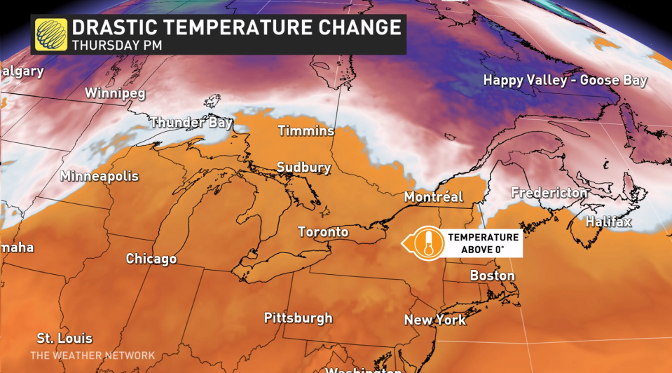
The trough responsible for all of our recent trouble will finally dislodge and scurry over the Atlantic Ocean, allowing a significant upper-level ridge to replace it. Ridges foster sinking air, which warms up as it descends toward the ground.
As a result, temperatures are going to climb toward the end of the week.
We’re looking at some relatively significant warmth building into Ontario and Quebec moving into New Year’s weekend. It’s not going to be shorts weather, of course, but daytime highs could climb into the double digits for some communities over the next week.
MUST SEE: People stranded by storm crashed at Walmarts in Ontario
Temperatures over the next seven days will average about 7-10 degrees above normal for just about all of Ontario and Quebec, with the greatest temperature anomalies falling across northern sections of the two provinces.
The latest forecast for New Year’s Eve on Saturday calls for a high of 5°C in Toronto and 3°C in Montreal; that doesn’t seem like much, but their respective seasonal highs for December 31 are 1°C and -3°C.

It’s not going to be a clean pattern change, unfortunately. Several disturbances and systems will swing through eastern North America through next week, bringing both Ontario and Quebec multiple opportunities for cloudy skies and occasional bouts of rain.
CHECK IT OUT: Our top picks worth checking out during Boxing Week
Even with the risk for showers and gloomy clouds lurking for the duration, though, the above-seasonal temperatures are going to feel downright refreshing compared to recent conditions.
If you live in an area that’s gotten hammered with heavy snows recently, it would be a good idea to clear snow away from storm drains and downspouts before temperatures rise in order to give the coming snowmelt plenty of leeway to drain without incident.
Check back frequently for the latest on this impending warmup across Ontario and Quebec.

