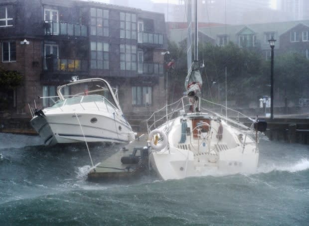
As Hurricane Teddy bears down, Maritimers plan for power outages and heavy rain

It's been a very active hurricane season in the Atlantic.
It's not even October and already we've blown through the first, alphabetized list of 22 named storms and moved into the Greek alphabet list. This is the most active Atlantic hurricane season since record-breaking 2005, when 28 storms were named.
And though it's been quiet so far in the Maritimes, that looks set to change next week.
There's growing consensus that Hurricane Teddy will track into the Maritimes on Tuesday into Wednesday with strong winds, heavy rain, storm surge and pounding waves. Late Friday morning, Teddy was still a Category 4 hurricane in the mid-Atlantic. By Friday evening, it was a Category 3 hurricane.
At this point we are still too far out to know exactly where Teddy will make landfall, how strong the storm will be and who will see what impact.
But assuming the storm moves into the region as currently forecast, there are some things we can safely assume.
There will be strong winds and power outages. Whether the storm arrives as a Category 1 hurricane (which means sustained winds between 118 and 153 km/h), as a transitioning storm or a post-tropical storm, the winds will be very strong. The trees are in full leaf, so count on power outages.

There will be heavy rainfall and the potential for localized flooding. Most storms from the tropics bring heavy downpours and rainfall in excess of 50 millimetres. At the moment, Teddy looks no different.
Storm surge and pounding surf will also be an issue.
Unlike last year's Hurricane Dorian, this storm currently looks set to slow down as it moves into the region. That means there will be more time for possible impact along the coast. This part of the forecast is particularly dependent on the exact track and timing, with high tide versus low tide set to be a major factor.
What should you do?
Stay tuned to the forecast. And when you're watching the updates over the next few days, it's important to remember that the cone of uncertainty — the storm's possible path, as seen on weather maps — represents where the centre of the storm might track. With Teddy likely becoming a post-tropical storm, its impact will be far-reaching from the centre.
That's because unlike hurricanes, which are fuelled by the ocean, post-tropical storms are more like conventional storms — they're fuelled by temperature contrasts and affect wider areas.
Check your emergency kit. Now is the time to make sure your kit is ready to go. It's recommended that you have supplies in your home to last 72 hours. Little things like checking your flashlight batteries, topping up your car and filling your propane tank will go a long way if we're dealing with power outages.
With the storm still days away from a potential landfall, it may seem a bit early to be running around and checking emergency kits. However with COVID-19, checking your list off early and reducing last-minute crowds at the stores will be helpful for everyone.
Best-case scenario, you don't need your kit and it's ready to go for the upcoming fall and winter storm season.
WATCH | Ryan Snoddon's Hurricane Teddy forecast:
Keep up to date with our live weather blog, updated every day.
MORE TOP STORIES


