
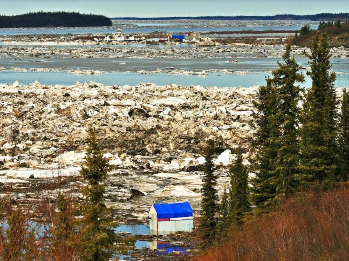
Ice jam moves past Tsiigehtchic, N.W.T., after flooding ferry ramp
An ice jam on the Mackenzie River started flowing again near Tsiigehtchic, N.W.T., on Wednesday.
"The water level, it was pretty high," said Charlene Blake, who lives in the community at the confluence of the Mackenzie and Arctic Red rivers.
Blake said the water reached its highest point on Tuesday, coming over the road that leads into Tsiigehtchic and flooding out the community's ferry ramp that provides access to Inuvik.
"The ferry camp had to get evacuated on the weekend, Saturday morning they had to leave camp because of the high waters," she said. "Usually that ferry is way up, like it's way up off the water mark."
Blake said a lot of people are saying they've never seen the water get that high before, and they're also wondering if it'll lead to floods downriver, in Aklavik.
At around 1 a.m. Wednesday, however, Blake said the ice started moving. She hopes it continues to flow, so that by the weekend it'll be possible to go out boating and hunting for ducks.
"Once the ice clears, boats will be in the water."
According to a water monitoring bulletin from the territorial government on Wednesday evening, the ice jam had reached Point Separation, a spot along the Mackenzie River north of Tsiigehtchic, and ice and water from the jam had moved into the Delta.
The territory said that it did not have hydrometric data, but that there were reports that the water levels around the ferry crossing in Tsiigehtchic were receding.

