
'Large upper ridge of high pressure' brings sunshine and mild weather to Saskatchewan
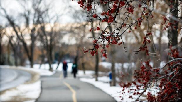
December in Saskatchewan has rolled in like a lamb.
A high-pressure system hovering over Western Canada means the forecast across the province for the week ahead is downright balmy.
This upward trend continues into the second week of December, with temperatures expected to almost reach double-digit positive highs. By Monday, areas like Moose Jaw and Swift Current will be seeing daytime highs around 8 C. Not only will there be lots of sunshine with limited cloud, the ever-relenting Saskatchewan wind even take a break.
"[There is a] large upper ridge of high pressure that has built over Western Canada bringing unseasonably mild air over all of Western Canada including the Yukon and NWT," said Terri Lang, Meteorologist with Environment Canada,
Yes, you can get your capri pants back out of storage.
Even northern communities like Uranium City and La Ronge will get a taste of this mild Pacific air. Seasonal daytime highs for Uranium City are usually -15 C, but in the coming days it will be closer to -3 C and later into next week there are days expected to be above freezing at 2 C.
Protected prairies
Saskatchewan is being temporarily shielded from the cold by a massive flow of pressurized, sinking air, said Dave Phillips, a senior climatologist with Environment Canad.
"It's clearly an atmospheric gift. You don't expect weather like this." Phillips said.
This warm snap started at the end of November and looks to extend well into the second week of December.
But there is also a big minus with these mild temps.
"[There's] the loss of valuable snow pack [moisture in the bank for farmers] plus with temperatures falling below freezing each night, the melted roads are likely to ice up." said Lang.
Icy roads are being blamed for a four-vehicle crash which resulted in a death Tuesday night Delisle. Saskatchewan Highway Hotline had issued a "Travel not advised" earlier in the afternoon indicating that Highway 7 was ice covered.
So when will winter return?
"The ridge looks to collapse around mid next week, returning Saskatchewan to more seasonal values" said Lang.
Lang also said this isn't entirely unusual for this time of year.
"In southern Saskatchewan, as seen by the record temperatures for around this time, it's more unusual for Yukon & the NWT, where records are going to be set and by a fair margin."
Statistics for the meteorological fall (Sept - Nov) show Saskatchewan experienced below average temperatures thanks to the extreme cold during October. Despite the massive dump of snow in mid-November, Saskatchewan also saw below average precipitation values.
However you look at it, a little shot of warm air and clear skies is likely a welcome weather anomaly.
