
Newfoundland, southern Labrador get another onslaught of winter
All of Newfoundland and most of southern Labrador is under some kind of weather warning Tuesday, as transit, government offices and municipal services are closed or delayed opening due to the stormy conditions.
"It's on your doorstep right now," said Environment Canada meteorologist Wanda Batten on Tuesday morning.
The storm began overnight Tuesday in the island's southwest, with heavy bands of snow moving into the Gander and St. John's areas through the morning.
The storm has prompted many delays and cancellations. The province closed some sections of the Trans-Canada Highway on the west coast, and asked drivers to avoid travelling if possible.
Witless Bay Line was closed due to poor weather conditions, with RCMP asking motorists to avoid the highway between Witless Bay and Butter Pot Park due to whiteout conditions.
In St. John's, Metrobus announced it would be suspending transit services as of 10 a.m. due to the weather. They City of St. John's also pushed garbage collection scheduled for Tuesday to Wednesday, with other municipalities in the metro region following suit.
Provincial government offices in parts of the province closed for the morning, as did courts in St. John's. The College of the North Atlantic closed some of its campuses for the morning, while the Newfoundland and Labrador English School district said some virtual classes may be disrupted.
The weather cancelled flights at airports in the province, with Marine Atlantic also cancelling its crossings for the day. Newfoundland Power reported outages in the Bay St. George South and St. George's areas due to severe weather conditions.
"It's going to be quite blustery there for a few hours," Batten said.
"I expect this to come in, and it's going to deteriorate really quickly, and then it's going to improve quickly as well," she said, forecasting the worst is to come in the morning and early afternoon, before the snow lets up and the winds drop later Tuesday.
On the west coast, between five and 15 centimetres of snow is on the way, but up to 25 centimetres could fall in some higher-elevation areas, along with wind gusts between 80 and 120 km/h into Tuesday afternoon.
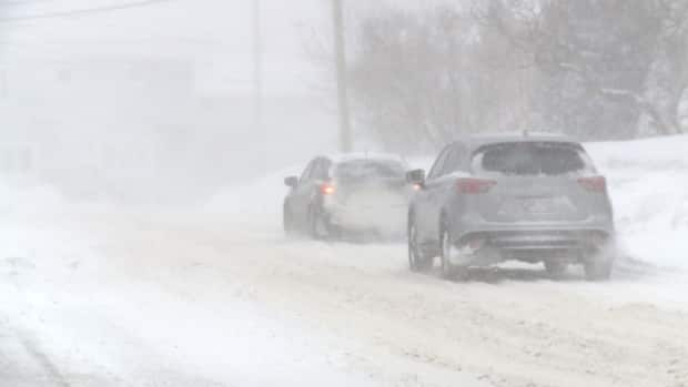
For St. John's, the northern Avalon, and the Bonavista Peninsula, strong winds gusting up to 100 km/h are expected to combine with about 15 centimetres of snowfall starting Tuesday morning. Environment Canada said "visibility will be suddenly reduced to near zero at times in heavy snow and blowing snow."
It's a similar story on the southern Avalon, Connaigre and Burin peninsulas, where 10 to 15 centimetres of snow is expected — though it may change to a brief period of rain later this morning, before turning back to flurries this afternoon.
In southern Labrador, the area from Norman Bay through to Red Bay and L'Anse-au-Clair could get up to 45 centimetres of snow, and conditions on the Trans-Labrador Highway are expected to be rough.
'Nasty conditions' for drivers
Early Tuesday morning the RCMP had responded to a few calls of stranded drivers on west coast roads, and Const. Matthew Christie said he expected conditions to get dicey in eastern Newfoundland later in the morning — especially on the Trans-Canada Highway between Butter Pot Park and Witless Bay Line.
"Those areas, we've seen in the past, when the snow kicks up and the wind combines with it, it makes for nasty conditions," he said.
"So I would expect those areas to deteriorate quite quickly as people make their way toward the city."
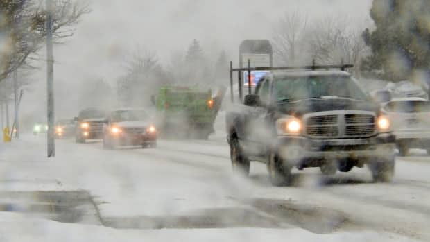
If they have to be out, Christie said drivers should take it slow.
"Mostly what we see is just people failing to adjust their driving to the road conditions," he said.
"Those posted speed limits — whatever the posted speed limit is for the area that you're travelling in — that's meant for ideal conditions. So if you have the snow, and you have the wind that's with it, and you have the slippery surface on the roadway, that speed limit is not something that you should be travelling."
Cold weather coming
Once the system moves out, said Batten, there should be consistent flurries and strong winds over the next few days.
"We're in for pretty blustery weather in behind this," she said. "It actually could get quite nasty along the west coast and Northern Peninsula Wednesday into Thursday."
Batten said it will also get colder, with temperatures dropping to minus double digits in western and central areas of Newfoundland.
