
Wildfire about 3km from Tumbler Ridge townsite more than doubles in size
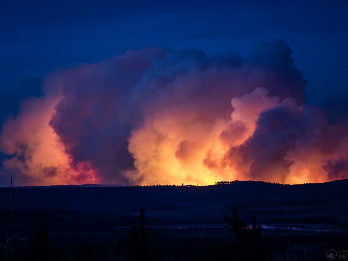
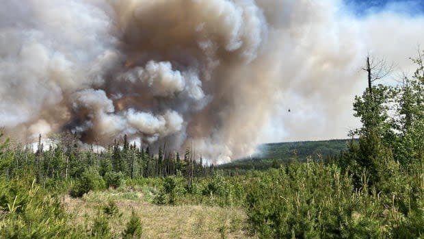
The West Kiskatinaw River wildfire burning in northern B.C. — now an estimated 230 square kilometres in size, up from 96 square kilometres on Thursday — is pushing closer to the evacuated town of Tumbler Ridge.
Forrest Tower, information officer with the B.C. Wildfire Service (BCWS), said Friday morning the blaze is four to five kilometres away from Highway 52, which runs through Tumbler Ridge.
Meanwhile, the District of Tumbler Ridge is reporting the fire as being "about three kilometres away" from the townsite.
"We continue to see pretty extreme fire behaviour pretty much every day since this fire has started," Tower told CBC. "We're expecting it to remain very aggressive starting pretty early this morning, expecting torching, candling."

Tower said the fire "is not receptive to any sort of suppression activities that we would normally be able to do" and wind is pushing the fire "in a westerly direction, which is still toward the community of Tumbler Ridge."
Tower said a wind shift — which would push the fire in the opposite direction — is expected Saturday.
"If we do get a wind shift, good news for the community."
Officials are urging residents under evacuation order to flee immediately, and register themselves at one of the three reception centres or online.
Officials also say the West Kiskatinaw fire is burning 15 kilometres away from the nearby Peavine Creek fire, prompting an evacuation order affecting nine homes Thursday evening.
'Not in the clear' as of Friday afternoon: official
In a Friday afternoon update, Carly Derosier from the wildfire service said their biggest concern is the fire will cross Bear Hole Lake Road, at the bottom of a valley just east of Tumbler Ridge.
If that happens, Desrosier said the fire will likely head up the slope toward Tumbler Ridge as fires burn more easily uphill.
She said the fire is growing on all sides, not just toward the wind but also against it.
"We are certainly not in the clear at this point, but we are leaning toward a little bit of cautious optimism, hopefully that wind will shift earlier than it is forecasted to," said Derosier.

On social media, the District of Tumbler Ridge said the wind shift in the westerly direction pushed the fire "parallel to the ridge, about three kilometres away from Tumbler Ridge."
Protecting town structures
Dustin Curry, district fire chief, said they are prioritizing protecting critical infrastructure like the town's main water reservoir and homes likely to be hit first by the fire.
As of Friday afternoon, 60 structural protection personnel are on site — with more arriving in the coming days — as well as 31 pieces of heavy equipment to assist in building fireguards.
The district said fire rescue personnel are conducting patrols, watching for spot fires from falling embers.
RCMP have also remained in Tumbler Ridge, conducting patrols to ensure the safety and security of homes.
Emergency workers are being housed in a local community centre, complete with food, facilities and amenities.
About 2,400 affected by evacuation order
Highway 52 East and North is closed due to the wildfire, which was discovered Tuesday.
Tumbler Ridge residents were ordered to evacuate on Thursday. According to the district, "the vast majority of residents" had left by 10 p.m., with a "core group" of emergency workers, volunteers and Emergency Operation Centre staff members remaining "on standby," along with Mayor Darryl Krakowka and council members.
The evacuation order covers the District of Tumbler Ridge, home to roughly 2,400 people in northeastern B.C., as well as properties to the east, including homes at Bearhole Lake.
As of Friday, Dawson Creek and Chetwynd have limited to no availability for hotel lodging, but some camping spaces remain available in those areas. Those in need of a hotel should head to Fort St. John — 170 kilometres north of Tumbler Ridge — where they can register at the Pomeroy Sport Centre.
Some residents remain
Krakowka says although most residents left Thursday, some remain as of Friday evening. Curry confirmed 90 per cent of Tumbler Ridge residents have evacuated.
'"We hope the residents are watching and paying attention," said Krakowka. "That they realize at a point they would have to leave."
Tumbler Ridge resident Tim Croston says he decided to stay to save his property and help neighbours.
As of Friday afternoon, Croston says he has gone to about 100 houses in the community to turn off gas valves, and has requests to do another 100.
"I felt that this was important and I do what I can to save our place," said Croston.
He says has also acted on requests from residents to feed livestock, search for pets that were lost during evacuation, and recover valuables from peoples' homes.
Those in Tumbler Ridge can check the district's website and Facebook page for updates.
Drought also a factor
While a chance of rain is in the forecast for Saturday, Tumbler Ridge is in an area experiencing drought conditions.
The River Forecast Centre shows snowpack levels at 49 per cent below normal, as is the case for much of the province. The hottest May on record resulted in a rapid melt and record-low snow levels in most B.C. mountains by June 1.
A relatively warm and dry winter and spring, as well as the lingering effects of a drought in the fall of 2022, are also contributing to current conditions.
After possible rain showers Saturday, temperatures in the Tumbler Ridge region on Sunday and Monday are expected to reach 26 C, with no precipitation. Rain showers are a possibility Tuesday through Thursday, with temperatures dipping to about 17 C.
Check the CBC News Climate Dashboard for live updates on wildfire smoke and active fires across the country. Set your location for information on air quality and to find out how today's temperatures compare to historical trends.

