
It's just plain 'nasty' out there: Here's a blow-by-blow of Tuesday's storm
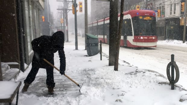
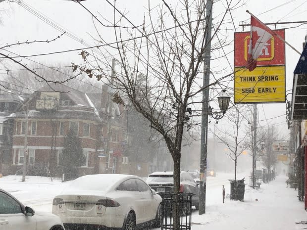
The snow is coming down across the Greater Toronto Area and, when this latest storm is done, there could be between 15 and 25 centimetres of snow and ice pellets on the ground.
All of southern Ontario has been under a winter storm warning since Tuesday morning, with the snow changing to ice pellets in the afternoon.
Freezing rain also came down late in the afternoon, according to Environment Canada.
Here's how the day played out, and what's expected next:
Midnight to 7 a.m. – The calm before the storm
While there wasn't any precipitation overnight, wind gusts kicked up to about 50 km/h and stayed strong throughout the day. For early birds getting to work before 8 a.m. ET, the roads were clear.
But that didn't stop a number of school boards from cancelling classes outright, including the Toronto District and Toronto Catholic District School boards. A full list of closures and bus cancellations can be found here:
For a look at how the day unfolded in pictures, check out this photo gallery:
8 a.m. — It begins
The snow started falling around 8 a.m. in Toronto — and was heavy from the start.
Winds were also expected to pick up to 80 km/h Tuesday night, with the strongest gusts along the lake shore, according to Environment Canada meteorologist Ryan Rozinskis.
"We know there's going to be an increased number of fender benders and crashes," Toronto police Sgt. Brett Moore said Monday.
Slow down, he said on Twitter. And if you're in a minor crash, get your car off the road. Officers will be tied up and won't be able to quickly get to all accidents.
City of Toronto liquid de-icing trucks put down a layer of brine on the main arterial roads and expressways, which helps keep the snow from bonding to the road, said Mark Mills, superintendent of road operations. Salting operations began shortly before 8 a.m., he said.
The threshold for plowing is 2.5 cm on expressways, 5 cm on main arterial roads and 8 cm on local roads, he added. You can track the city snow plows here.
"It's going to be a day to exercise patience while you're driving," Mills said.
10 a.m.
By late morning, the snow engulfed the rest of York Region and Durham.
There were high winds throughout the day and into the night, and it was "nasty," said CBC meteorologist Colette Kennedy.
12 p.m. — The ice pellets cometh
Lunchtime got a little painful.
The snow began transitioning to ice pellets at some point between noon and 3 p.m., according to Rozinskis, depending on where you are in the GTA.
That meant less blowing snow, but the road conditions would still be bad.
1 p.m. - Possible power outages In case of power outages, Toronto Hydro had extra crews at the ready on Tuesday.
5 p.m. — Freezing rain
The freezing rain arrived at 5 p.m. with the wind slightly weaker than Tuesday morning but still be gusting as high as 60 km/h into the evening.
Areas farther west and south of Toronto, like Kitchener and Hamilton were expected to see longer periods of freezing rain, Rozinskis said.
The city sent 200 salters, 300 sidewalk plows and 600 road plows onto Toronto's streets to keep things clear, but officials still warned people to expect the trip home to take longer than normal.
The TTC, meanwhile, diverted some buses around slippery, snowy hills.

7 p.m. — Hello snow, my old friend
The ice pellets changed back to snow by Tuesday evening.
That snow will last through Tuesday night into Wednesday, gradually becoming lighter, said Rozinskis.
10 p.m. — It ain't over til it's over
Rozinskis warns of 5 to 10 cm of snowfall on Tuesday night, and an overall total of up to 25 cm for the day.
And keep your hat on — winds around 60 km/h should last through the evening and into Wednesday.
The morning after
There may be periods of snow on Wednesday, but only up to 5 cm, Rozinskis said.
But the day's commute may still be rough.
Rozinskis recommends keeping up to date, as weather conditions change.