
Riskiest Hurricane Day Approaches
Hurricane season may have officially started on June 1, but the riskiest part of the season is only just beginning, said scientists at the National Oceanic and Atmospheric Administration (NOAA).
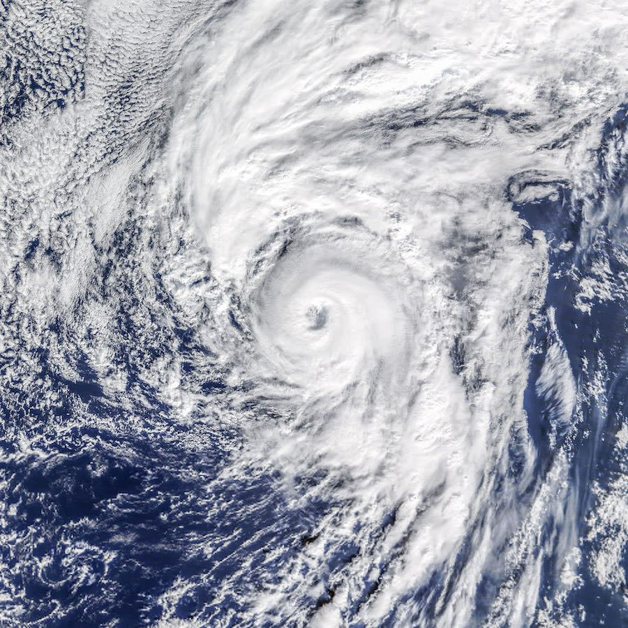
Tropical cyclones typically spike during an eight-week period that lasts from mid-August through the middle of October, NOAA scientists said in a statement on Aug. 22. Tropical cyclones include "tropical storms," defined as storms with winds reaching 39 to 73 mph (62 to 117 km/h), and named hurricanes, defined as storms whose winds reach 74 mph (119 km/h.)
This "peak season" includes 78 percent of tropical storm days, 87 percent of days with Category 1 and 2 hurricanes on the Saffir-Simpson scale, and a dizzying 96 percent of the major hurricane days (Category 3, 4 and 5), the NOAA said. Turns out the day you're most likely to see one of these storms is Sept. 10. [A History of Destruction: 8 Great Hurricanes]
The NOAA's 2016 hurricane forecast, released at the end of May, predicted the year would see a total of 10 to 16 named storms, which includes tropical storms and hurricanes. The agency updated that outlook in August, calling for a 70 percent chance of 12 to 17 named storms. The NOAA said it expects this season to be the most active since 2012. In fact, the Atlantic region has experienced a hurricane drought over the past three years, with just four hurricanes and seven tropical storms in 2015.
Why an August peak?
If the hurricane season starts in June, why are there so many hurricanes in August? Three ingredients come into play: wind, temperature and moisture, according to the NOAA.
Wind shear, a force that can disrupt storms before they strengthen, is high in May and gradually decreases through June and July, reaching its lowest level by mid- to late-August. Temperature and moisture also tick toward optimal for storm formation in August. Ocean temperatures rise as the summer sun heats up waters in the deep tropics, the air continues to warm up and atmospheric moisture increases. All of these favorable conditions sync up during the eight-week peak period, or as the NOAA refers to it, the "season within the season."
These storm-nurturing features wane as the Atlantic region enters October, and by the middle of that month, stronger wind shear breaks up organizing storms while air and water temperatures dip.
So far this season, seven named storms, including two hurricanes (Alex and Earl) have hit the region. Four of these storms made landfall: Bonnie hit South Carolina; Colin made landfall in western Florida, Danielle in eastern Mexico, and Earl in Belize and Mexico, according to the NOAA.
Tropical cyclone Gaston, currently looming in the eastern tropical Atlantic, is expected to reach hurricane status today (Aug. 24), according to news reports. Tropical storm Hermine may be brewing in the Atlantic Ocean, reported Accuweather.
The hurricane season officially ends Nov. 30. The NOAA urged people living along the Atlantic coast to remain vigilant regardless of whether it's August or November.
Original article on Live Science.
Editor's Recommendations
Name That Hurricane: Famous Examples of the 5 Hurricane Categories
Photos: Skydiver Sean MacCormac 'Surfs' on Thunderstorm Clouds
Copyright 2016 LiveScience, a Purch company. All rights reserved. This material may not be published, broadcast, rewritten or redistributed.
