
Tropical Storm Sally roars through Gulf, forecast to strengthen to hurricane before landfall near Louisiana-Mississippi border
Tropical Storm Sally triggered evacuations in Louisiana on Sunday as the northern Gulf Coast prepared for it to make landfall late Monday as a hurricane with 90 mph sustained winds.
Hurricane and tropical storm warnings were in effect for a swath of the northern Gulf Coast from the Florida Panhandle to Morgan City, Louisiana, as Sally gathered strength. The storm appears likely to make landfall somewhere near the Louisiana-Mississippi border, potentially in New Orleans, according to forecast models.
After landfall, rapid weakening is forecast, and Sally is expected to become a tropical depression by Wednesday and dissipate by Friday, the National Hurricane Center reported.
"It's possible we could see winds of 100 mph, with gusts to 120 along the coast as Sally makes shore," said Ben Schott, meteorologist-in-charge of the National Weather Service office in New Orleans.
The developing worry for the region is the potential for Sally to slow to a crawl, bringing a long period of wind and rain. When it approaches the coast it could be moving as slow as 3 to 5 mph, Schott said.
The NHC warned Sally could bring rainfall along the Gulf Coast of 8 to 16 inches, with isolated amounts of up to 24 inches, over the next several days, as well as life threatening storm surges and hurricane force winds.
Schott and Louisiana Gov. John Bel Edwards warned that Sally could experience a rapid intensification over the warm waters of the Gulf of Mexico.
"The sea surface temperatures are well above average and will provide plenty of energy for it to continue to intensify as it moves across the Gulf," Schott said. The only limiting factor would be wind shear.
Wind gusts of 40 to 60 mph are forecast from the Florida Panhandle to eastern Louisiana.
"Life-threatening storm surge, torrential rainfall, and damaging winds (are) expected to move into the area late Monday and continue for the better part of Tuesday before improving Wednesday morning," the Weather Service said.
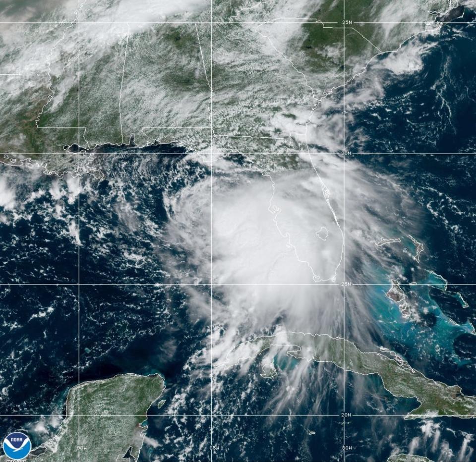
Sunday evening, the storm was centered 140 miles south of Panama City, Florida, and about 185 miles east-southeast of the mouth of the Mississippi River. It was moving west-northwestward at 8 mph, with maximum sustained winds of about 60 mph.
More on the horizon? Record-setting season puts coastal states at increased risk of a hurricane landfall
Sally is forecast to whip up a storm surge of as much as 7 to 11 feet for parts of Louisiana and coastal Mississippi, with the highest potential in east-facing portions of southeastern Louisiana.
Edwards urged Louisiana residents to prepare for a new threat, even as they continue to recover from Laura.
"This storm represents a very significant threat to the people of southeast Louisiana," Edwards said in a briefing Sunday afternoon.
Hurricane Laura carved a path of destruction through Louisiana on Aug. 27, the strongest hurricane ever to make landfall in the state, and the region is still recovering.
"This, when combined with the COVID-19 pandemic, can make us all weary," Edwards tweeted. "I implore Louisianans to take their preparations seriously."
Edwards declared a state of emergency, and evacuations were ordered for some parts of southeastern Louisiana.
New Orleans Mayor LaToya Cantrell, who noted the city is providing shelter to some people left homeless by Laura, ordered a mandatory evacuation for areas outside the city's levee system, effective at 6 p.m. local time Sunday.
"Prepare today," Cantrell said Sunday. "Gather emergency supplies including food, water and medication for at least three days."
'Extraordinary work' underway to rebuild electric, water, cell grid after Laura
Mississippi Gov. Tate Reeves on Sunday declared a state of emergency ahead of Sally's arrival, too.
South Florida took the early brunt of Sally's power Saturday, soaking the southern Florida Keys. Nine to 12 inches of rain fell Saturday morning to Sunday morning, prompting a flood advisory.
Key West reported a little more than 9 inches at midnight, its fifth-highest daily total. That included a one-hour total of almost 4 inches Saturday night. The National Weather Service office in Miami reported about 3 inches of rain in Florida Gardens in Palm Beach County on Saturday.
The most powerful storm blasting through the Atlantic Basin is Hurricane Paulette, with sustained winds near 80 mph. Strengthening is forecast, and Paulette is expected to be a "dangerous hurricane" when it approaches Bermuda late Sunday and early Monday, the National Weather Service said.
This article originally appeared on USA TODAY: Tropical Storm Sally forecast to become hurricane ahead of landfall

