
After several days of summer heat, rain is on the way for parts of southern B.C.
After several days under the grip of a summer heat wave, the South Coast of B.C. is expected to begin a slide into cooler, wet weather on Wednesday night.
The early hours of the day will be warm, according to CBC meteorologist Johanna Wagstaffe, with temperatures reaching up to 29 C in Vancouver. But an approaching cold front will bring increasing clouds as the evening progresses.
Rain will begin after midnight, Wagstaffe said.
Light showers are expected to linger through Thursday, bringing between five and 10 millimetres of fresh rain to the city. Temperatures will be cooler, with highs of just 20 C.
Wagstaffe said the weather will dry out again by Friday and stay dry into the weekend.
Rain welcome in wildfire fight
The meteorologist said the same cold front dampening the South Coast will also bring much-needed rain to other parts of the province. Areas currently seeing a high fire danger, such as those on southern Vancouver Island and in the east Kootenay, could see up to 20 millimetres of rain.
More than 40 wildfires, all less than 25 hectares in size, were burning in the province as of Wednesday morning. Only one, the Dry Lake fire near Princeton, B.C., has prompted an evacuation alert.
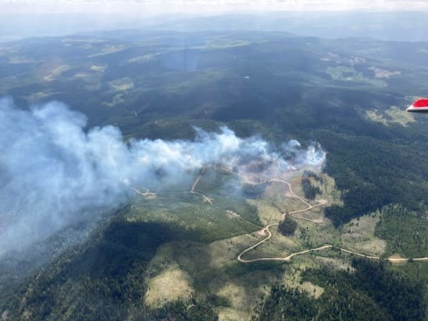
The B.C. Wildfire Service said lightning storms across the southern Interior sparked 22 new fires in the region over the long weekend, after a damp spring delayed the beginning of wildfire season.
The wildfire danger map shows much of the southern quarter of the province is rated as high to extreme, but the majority of B.C. currently faces no more than a moderate risk.
Environment Canada is maintaining a heat warning for the north Thompson region, as temperatures are forecast to nudge 29 C.
