
Tornado chances pop up over the southern Prairies Friday

Thursday was the third consecutive day with tornado warnings across parts of the Prairies after Canada's second tornado of the year was confirmed in Alberta on Wednesday.
The pattern is ripe for additional severe weather across many of the same areas heading into this weekend, with Friday and Saturday both featuring a risk for damaging storms throughout the region.
DON’T MISS: A photogenic landspout filled the skies over Alberta on Wednesday
Friday
Areas: Saskatchewan and Manitoba
Weather: The risk for severe storms continues throughout the eastern half of the Prairies on Friday as instability blossoms across the region. Forecasters expect scattered storms in Saskatchewan with more isolated activity in Manitoba.
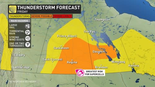
Numerous thunderstorms will develop across southern Saskatchewan through the afternoon and evening hours, with dynamics favourable for a few of those storms to organize into supercells. In addition to the risk for large hail and strong wind gusts, higher moisture levels over Saskatchewan will make torrential rainfall a hazard.
Most of southern Manitoba should remain storm-free with the exception of a few isolated cells across the region.
Saturday
Areas: Saskatchewan and Manitoba
Weather: The storm risk continues Saturday, with more severe chances on the horizon. As the high pressure starts to move west of the Great Lakes, some southern areas in northwestern Ontario and Manitoba will start to see storms become more isolated. However, the western and northern edge of the high pressure will continue to have the chance for some severe storms.

There is the chance for a few supercells to develop once again. The main threats are torrential rain, large hail, strong wind gusts, and even a risk of a tornado, albeit, still a small risk similar to Friday.
This Weekend
Saskatchewan and Manitoba will need to keep their eyes to the sky again this weekend as high heat, humidity, and moisture flowing north from stateside will contribute to renewed thunderstorm activity for several more days.
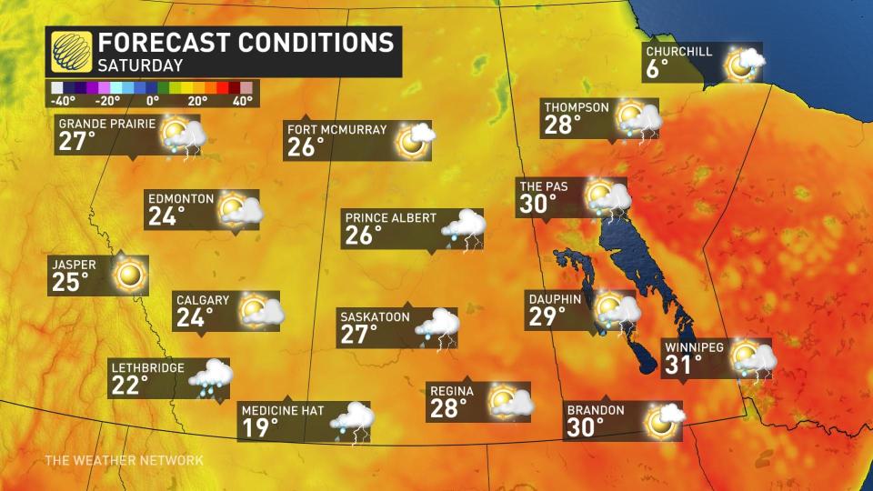
Summer-like heat will stick around through much of the following workweek, with temperatures in the upper 20s and lower 30s for many communities on the southern Prairies.
Prepare
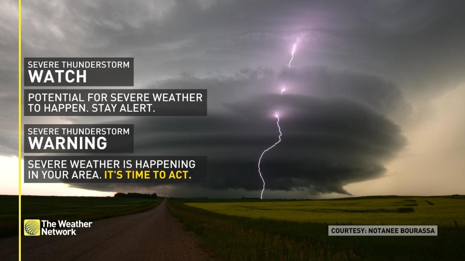
Stay alert and monitor the forecast for updates. Have a plan and a place to head indoors if the weather changes.
Watches mean conditions are favourable for the development of severe thunderstorms.
Warnings mean they are imminent or occurring in your area.
Thumbnail courtesy of Unsplash.
Stay tuned to The Weather Network for more forecast updates on the Prairies.
