
Southern Ontario snow could upend weekend travel plans
A dose of snow is in the cards for southern Ontario as many folks look forward to the start of the March Break this weekend.
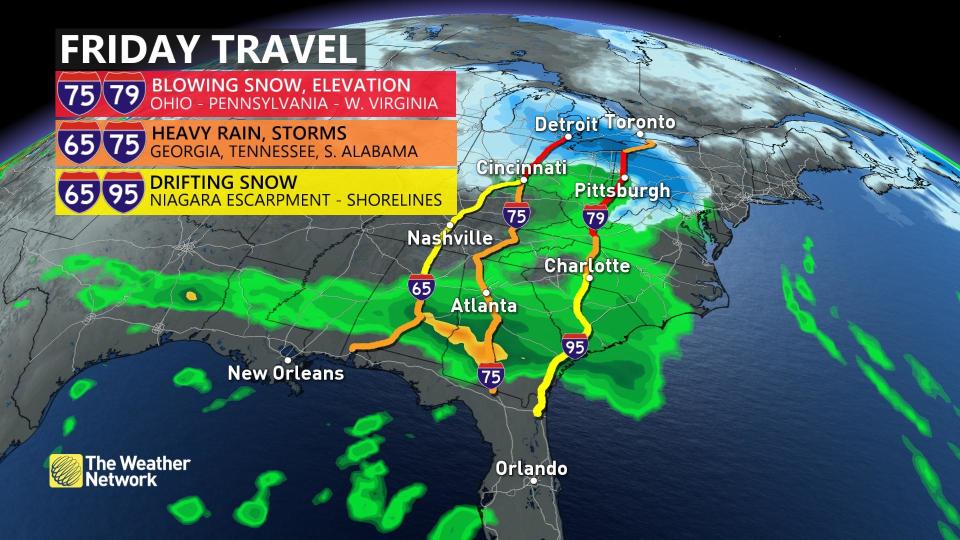
This system could disrupt travel plans for folks heading south for vacation, so travellers should pay close attention to the forecast over the next few days.
DON'T MISS: March came in like a lion, but can and will it go 'out like a lamb?'
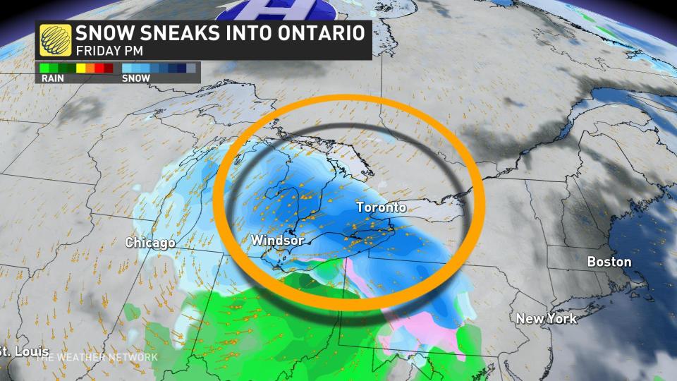
A fledgling Colorado low moving toward the Great Lakes to end the week will follow a similar track to last week’s storm, but on a smaller and weaker scale.
While this week's system certainly won't bring any blockbuster snowfall amounts, there is the chance for a few centimetres to accumulate across the Greater Toronto Area (GTA) on Friday.
Snow will begin pushing into the region overnight Thursday into Friday morning across southwestern Ontario, spreading toward the GTA for the morning commute. Snow will continue through the day before tapering off during the evening hours.
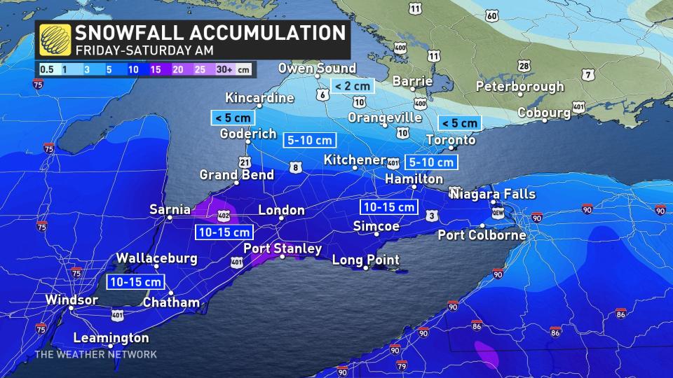
The heaviest snowfall should remain in southwestern Ontario, with a general swath of 10-15 cm possible from Windsor to Hamilton and east toward the Niagara Peninsula. Locally higher totals are possible. Easterly winds blowing off Lake Ontario could provide some enhancement near the western lakeshores.
MUST SEE: Ontario hit by 3 blockbuster snowstorms since autumn. Will there be more?
Regardless of total amounts, this system will have some impact on those who will be driving south for the start of March Break.
The snow departs through Friday evening, but light flurries will remain into Saturday morning. Another system is expected to track south of the region early next week and temperatures will be colder than seasonal for March Break.
Be sure to check back for the latest weather updates across Ontario.

