
Spring wastes no time in showing Ontario why it's a season of contrast
Spring is flexing its muscles early in Ontario.
Temperatures will be seeing a nice bump in the south mid-week, but there will be a rainy cost to it. Meanwhile, parts of northern Ontario will have to break out the shovels once again after last week's sizable dumping of snow.
DON'T MISS: Canada’s spring forecast: Sluggish spring slowly comes to life
A low-pressure system will develop over the Great Lakes on Wednesday, bringing rain and a bump in temperatures, and even the potential of a weak thunderstorm.
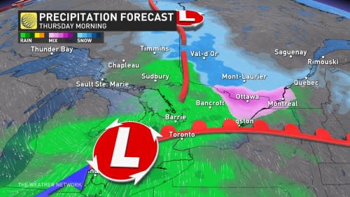
Rain will move in Wednesday evening and will persist throughout the day on Thursday, with possible embedded thunderstorms in the morning as an elevated pocket of instability translates into the southern Great Lakes. Snow is expected in northern Ontario during this time.

Temperatures will reach the double digits across southern Ontario in the warm sector of the low, with some daytime highs reaching into the mid-teens on Thursday in the extreme southwest.
Southeasterly winds will usher in a moist air mass that will help produce rainfall totals of 10-20 mm.
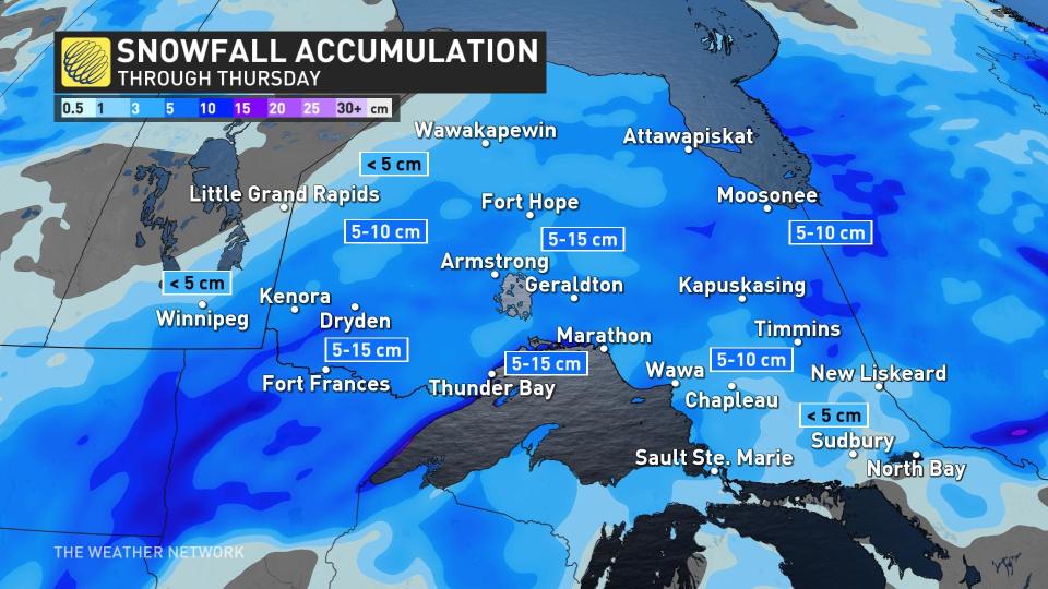
The rain-snow transition will sit north of the Sudbury region. Snowfall accumulations of 5-15 cm will fall in northern Ontario through Thursday. Not as much as the recent storm produced, but enough to warrant snow removal in some areas.
But this will just be the beginning of the active pattern. There's another system on course for the weekend that could bring rain and snow for southern areas, but more details will follow this week.
Beyond, changeable temperatures are expected for the final days of March through early April, with no sustained warm weather in sight.
Stay tuned to The Weather Network as we continue to update this week's forecast for Ontario.

