
'Thunder snow' warning after snowfall blankets parts of B.C. highway, western Alberta
It's just days before the summer solstice, but snow is still falling in parts of B.C. and western Alberta.
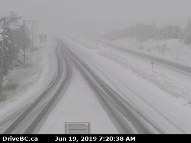
The surprise snowfall on sections of the Okanagan Connector was seen on DriveBC highway cameras on Wednesday morning.
Snow is visible at the Pennask Summit on Highway 97C, around 75 kilometres west of Kelowna and at an elevation of 1,717 metres.
Snow also covers the highway at Elkhart, which is at 1,621 metres.
"Right now, we've actually got a line of snow showers even with some lightning in there," said Lisa Erven, a meteorologist with Environment Canada.
"We're going to see the continuation of snow at least through the next couple hours here as these convective cells continue to move over the area."
That means a chance of "thunder snow," when it falls in a thunderstorm.
"It's quite unstable and there is actually some lightning showing up on our lightning detection network," said Erven.
"So, for those travelling on the highways, you could see or experience thunder snow, which is a unique phenomenon, but certainly not out of the question this time of year."
The freezing levels are at a higher elevation than the Coquihalla Highway and cities in the Southern Interior like Merritt, Kelowna, Vernon and Penticton.
Snow at these higher elevations is expected to turn to rain by Wednesday afternoon.
Snowfall warning in Jasper
Just across the B.C.-Alberta border, a snowfall warning is in effect for Jasper National Park and surrounding area for Wednesday.
Environment Canada said about 10 centimetres of snow are expected at higher elevations, including sections of the Icefields Parkway Highway, a major tourist attraction.
"That's what our warning is directed toward: higher terrain and for people travelling on Highway 93," Erven said
Wet flurries are also in the forecast for sections of Highway 1 in the Field, B.C., area overnight.
