
Tropical Storm Zeta to strengthen as hurricane overnight, becoming third to strike Louisiana in two months
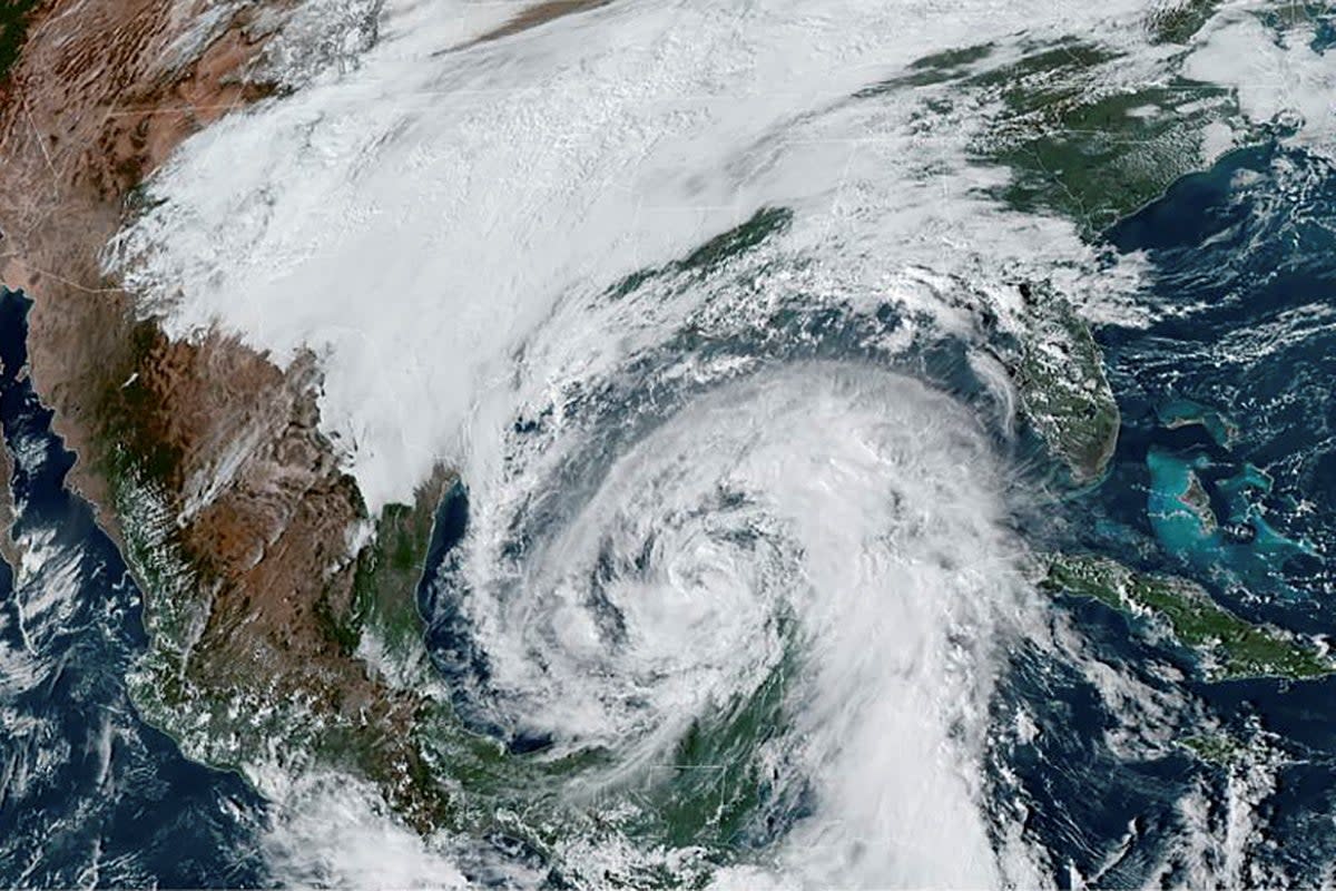
Tropical Storm Zeta is expected to strengthen to a hurricane overnight as it careens towards Louisiana’s coast, which has been in the “cone” of impact for seven storms over an unusually active Atlantic storm season that has devastated southwestern parts of the state.
The 2020 storm season has produced so many storms that officials cycled through the alphabet and then moved on to the Greek alphabet to continue naming them.
This storm season, which runs through November, has produced 27 named storms, including 12 hurricanes.
If Zeta remains on its current track, it will be the third hurricane to hit the state within two months, following hurricanes Laura and Delta. The state continues to shelter 3,606 storm evacuees, most from Hurricane Laura, which made landfall on 27 August.
Louisiana Governor John Bel Edwards declared a state of emergency on Monday.
“It’s imperative people use the time they have today and early tomorrow to prepare,” he said at a briefing on Tuesday. “No one should be complacent because it’s late October and feels like hurricane season should be behind us.”
The governor also called on Donald Trump to issue a pre-landfall Federal Declaration of Emergency on Tuesday.
“We are already coordinating with our federal partners to respond to Zeta, as we have been since the start of the [Covid-19] pandemic and throughout the recovery from Hurricanes Laura and Delta,” the governor said in a statement. "Louisianans along the coast and in the tracking cone should be making their final preparations today as Zeta will likely impact parts of the state tomorrow.”
The governor activated more than 1,700 National Guard service members as the state braces for impact.
After striking Mexico’s Yucatan Peninsula as a hurricane on Monday, Zeta was downgraded to a tropical storm. It’s expected to regain strength with strong, gusty winds and the threat of flash floods as it makes landfall on Wednesday afternoon, according to the National Weather Service.
The Tuesday afternoon forecast clocked the storm’s maximum sustained winds at 65 mph with higher gusts.
Under a tropical storm, winds can pick up from 39 mph to 73 mph. Category 1 hurricanes produce winds from 74 mph to 95 mph.
Storm surge warnings are in effect from the mouth of the Atchafalaya River to Navarre, Florida, as well as Louisiana’s Lake Borgne and Lake Pontchartrain and Alabama’s Mobile Bay and Florida’s Pensacola Bay.
Hurricane warnings are in effect from Morgan City, Louisiana to the Missisippi-Alabama border, as well as Louisiana’s Lake Maurepas and the entire New Orleans metropolitan area.
"I don’t think we’re going to be as lucky with this one,” New Orleans emergency director Colin Arnold said at a news conference with Mayor LaToya Cantrell on Tuesday.
“I don’t see it slowing down,” the mayor said of the rising threats of powerful storms amid the climate crisis. “We’re vulnerable, and we have to recognise that."
The city and southeastern parts of the state have largely been spared compared to neighbouring parishes on the state’s western border with Texas.
But this time, one of the city’s main turbines that powers the city’s antiquated drainage system is out of service, along with another turbine that has been downed since December.
The city’s Sewerage & Water Board advised that “residents should be aware if their neighbourhood normally floods, it may take longer for the water to drain.”
Three other turbines remain operational, but one if only for emergency use.
New Orleans’s 99 drainage pumps can drain up to an inch in the first hour they are operating, then half an inch of water every hour after that.
Zeta could produce up to 4 inches of rain over six hours, as the storm moves relatively quickly at 20 mph.
Winds and rain will increase across the region as the storm approaches, and hurricane-like conditions will hit the coast by late afternoon and early evening.
Inland areas could see several inches of heavy rains, with isolated amounts up to 6 inches and potentially damaging winds from eastern Louisiana to Alabama through Thursday.
As a likely weakened Zeta steers towards the eastern Appalachians on Thursday as a tropical depression, heavy rains and winds are possibly from western North Carolina to the mid-Atlantic coast, the National Weather Service reported.
Read more

