
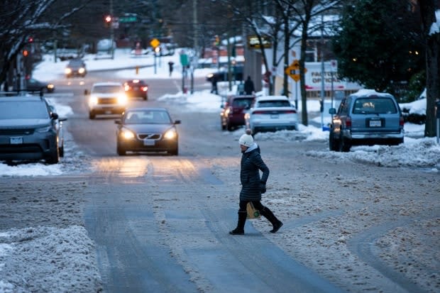
More snow on the way for B.C. South Coast with another storm set to hit late Friday
A fresh round of wintry weather alerts are in effect as yet another storm approaches the B.C. South Coast, including a new snowfall warning for Metro Vancouver and a severe wind warning for Greater Victoria.
Environment Canada has posted alerts stretching from the west coast of Vancouver Island through the Fraser Valley, with the storm expected to arrive Friday night.
Snow is in the forecast for the Lower Mainland, with up to 10 centimetres expected between Friday night and Saturday morning. A winter storm warning is also in effect for the Fraser Valley — including Chilliwack, Hope and Abbotsford — bringing the potential for hazardous road conditions.
Dangerous driving conditions are also expected on major highways, including the Sea to Sky, which is under a winter storm warning. A mixture of snow, freezing rain and strong winds is forecast for much of the weekend, starting with Friday night's storm. Up to 40 cm of snow is expected in Howe Sound by Sunday morning.
"The transition out of this Arctic air is taking longer than expected. We've got a pretty juicy system on the way," agency meteorologist Matt MacDonald said Friday morning.
Snowfall and wind warnings are in effect for nearly all of the Island, with forecasters expecting up to 15 centimetres of snow and winds up to 80 km/h.
Environment Canada is warning of possible damage and downed trees due to the high winds.
Winter-storm watches are in place for Howe Sound, Whistler and the Fraser Valley. Forecasters said snow, rain and freezing rain are all possible between Friday and Saturday, but heavy snow is expected first.
Winter-storm watches are issued when several types of severe winter weather are expected to happen together.
"This is going to produce what we call a messy meteorological medley," said MacDonald.
Special weather statements have been posted for Metro Vancouver and the Sunshine Coast, indicating a chance of similar weather.
The snow at the beginning of the storm will change to rain as warmer air arrives sometime before Saturday afternoon, but forecasters said it's tough to say exactly how long the snow will last before it changes to rain.
"Timing this transition to rain is always challenging in these situations. There is a chance that this transition could be delayed resulting in higher snowfall amounts. It is also possible this transition will include a period of freezing rain," an alert read.
The rain will create a slushy mess in many areas, with leftover snow from earlier storms still on the ground. Power lines can be weighed down by soaked snow, and storm drains can become clogged. MacDonald said residents can do their part by clearing blocked storm drains if they can safely do so.
Sheds, carports and other small buildings could also be at risk of collapse from the weight of wet snow.

Further north, Arctic outflow warnings remain in effect for much of the Central Coast, with an extreme cold warning in effect for the Peace River region.
Much warmer temperatures are expected for the South Coast through the weekend into next week, climbing up to 9 or 10 C in some areas — a drastic swing compared to the cold spell earlier this week.
B.C. has been battered by a series of storms since winter solstice on Dec. 21. The City of Vancouver experienced more snowfall this week than it usually does during most months of January.

