
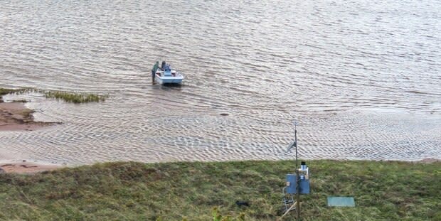
Weather station added on Hog Island to better prepare for climate change
The Mi'kmaq Confederacy of P.E.I. has partnered with the UPEI climate lab to install a weather station on Hog Island.
The weather station runs off solar power and monitors things such as rainfall, temperature and wind speed.
Don Jardine works with the UPEI climate lab and is helping to consult on the project.
"There's a lot of concern about Hog Island — if it ever washes away, and you get blow outs, then you could get impacts on Malpeque Bay," he said.
Data published in real time
Jardine said the station collects data in real time, which is updated every 15 minutes online.
"You can actually look on a link - hobo link, and you can actually see the weather conditions at Hog Island right now."
Since it was installed in October, Jardine said the information gathered has already provided some insight.
"The temperature readings were actually a bit milder than nearby stations further inland and I think that's because of the water temperature," he said.
"You have the Gulf of St. Lawrence on one side, you have the Malpeque Bay on other side."
Randy Angus is the director of integrated resource management with the the confederacy.
He said Hog Island is culturally important to the Mi'kmaq people and acts as a protective barrier to Malpeque Bay.
Angus said the confederacy has been doing work around climate change to look at both adaptation and the potential impacts to the Mi'kmaq community.
We're not looking at climate change as an emergency or a crisis right now, we're looking at adaptation. - Randy Angus, MCPEI
He said there's concern that the Hog Island dune chain may eventually breach due to accelerated sea level rise, which is why the weather station was added.
"In 2010, there was a storm surge event that nearly washed out the bridge that goes over to Lennox Island," he said.
"That same type of event in the future could wash out Hog Island itself, which would have serious impacts to Lennox Island."
Angus said the work is crucial to educate and prepare the community of Lennox Island.
"I think the important thing is that we're not looking at climate change as an emergency or a crisis right now, we're looking at adaptation," Angus said.
"We're gathering as much data and as much information as possible to help Lennox Island and Lennox Island residents [to] prepare themselves for future climate-change activity."
Data combined with drone surveys
Jardine said the plan is to monitor the region long term.
"Having some data to work with is kind of essential so you know what conditions you might expect, what kind of wind speeds," he said.
"It's helpful for planning purposes."

The data the climate lab collects will be combined with the drone surveys it has been doing for the last three years on Lennox Island to monitor coastal erosion.
"There's been a lot of talk about how the sands are shifting on Hog Island and other barrier bars all around the Island," he said.
"So we get some sense of knowing how that sand is shifting because you know, if we're going to get blow outs of those barrier bars and the sandbars, then this will give us some kind of indication of how often that could happen perhaps."
More P.E.I. news

