
Wild video captures rare ‘gustnado’ whipping up a waterspout over Ohio River
A boater in Cincinnati was treated to a rare and startling weather event over the weekend when they snapped a video of a “gustnado” sweeping across the river and creating a waterspout.
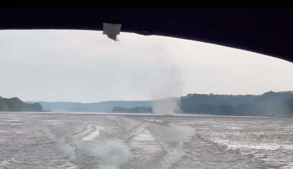
“Never seen a waterspout on the Ohio River,” wrote Twitter user @KSU_Evan in the caption of the clip of a daunting whirl of wind whipping across the body of water and trailing close behind his boat. “In retrospect we probably shouldn’t have gone boating today…” he added, sharing pictures of the ominous clouds that produced the rare weather event.
The National Weather Service confirmed that on Saturday 21 May, at approximately 5.10pm, an eyewitness filmed the swirling column of air over the 981-mile long Midwest river.
The boater had captured it first making landfall just offshore of Sayler Park, a neighbourhood in Cincinnati, before it peeled off towards land and wrecked damage on the numerous trees, some of which were entirely uprooted while others fell onto residential homes and power lines.
The NWS estimates that the gusts from the weather event reached between 70 to 80mph.
Never seen a waterspout on the Ohio River… pic.twitter.com/kL5qPLfeNK
— Evan (@KSU_Evan) May 21, 2022
Typical gustnadoes, which are different from tornadoes as they do not connect with any cloud-based rotation, are classified by the NWS as being a “small whirlwind which forms as an eddy in thunderstorm outflows”.
This particular gustnado, the NWS added, was not directly associated with a thunderstorm updraft, confirming later that it likely formed several miles ahead of the thunderstorm that was detected in the area.
Where tornadoes are formed from thunderstorms rotating around themselves, gustnadoes form along gust fronts, which are composed of a broader mass of air separated by a warm front rising and cold air sinking out from below.
Because these swirling winds rely on the friction created by the rising warm air and the cool downdraft, they tend to be short-lived.

Like tornadoes, however, meteorologists have been unable to draw a clear link between the occurrence of gustnadoes and the climate crisis.
Modern data for studying tornadoes, ABC News Chief Meteorologist Ginger Zee told the news outlet, only goes back 35 years, presenting one major challenge to drawing concrete links between a warming planet and the occurrence of the major weather event.
What meteorologists can confirm, however, is that the ingredients for making a tornado – and, similarly, what it takes to make a gustnado – are likely to increase with climate change.
More specifically, these weather events rely on heat, moisture, wind shear and lift, all of which will likely increase as the global average temperatures continue to rise.
There were no injuries or fatalities reported with this past weekend’s gustnado.

