
Rough morning commute likely in Ontario as snow, ice move in
A dynamic bout of wintry weather that pushed into southern Ontario on Thursday evening will make for a dicey Friday morning commute for much of the region.
The type of precipitation you see will depend on where you are in the province.
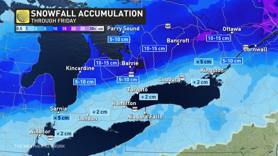
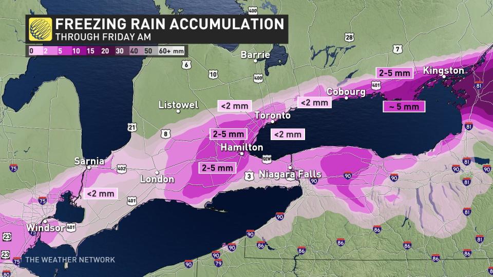
While a modest snowfall is on tap for many areas, warmer air nosing its way in just above the surface will force much of the precipitation to fall in the form of ice pellets and freezing rain, especially across the Greater Toronto Area (GTA) and south.
EXCLUSIVE: Wild ride to the winter finish line in Canada, find out your fate
Texas low ushers in colder air, wintry precipitation
A Texas low trekking south of Ontario is responsible for the messy conditions we’ll experience into the first half of Friday.
Precipitation pushed into southern Ontario on Thursday evening, becoming heavier across the region through the nighttime hours.
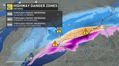
Icy roads will present a hazard to motorists through early Friday morning across a large swath of southern Ontario.
Colder air parked north of the GTA will make this a mostly snow affair for the duration of the event. Forecasters expect general totals of 5-10 cm through Friday morning.
Across and south of the GTA, though, marginal temperatures through the atmosphere will make for a much dicier set-up as precipitation falls in the form of ice pellets and freezing rain.
The greatest risk for ice pellets will fall just north of the GTA, slicing through southern Ontario along a line stretching from Goderich to Peterborough to Cornwall.
Farther south, there will be just enough warm air above the surface to allow for a period of freezing rain. The bulk of the freezing rain will fall on the Niagara Escarpment, as well as in southeastern Ontario around Kingston.
Residents should prepare to wake up to a slick start to Friday as the system pulls off towards the east, temperatures fall, and precipitation transitions to snow.
Behind this system, temperatures will also temporarily tumble to subfreezing values leading to a chilly start to the Family Day long weekend.
DON'T MISS: It may be mild, but the snowiest months are just ahead for these parts of Canada
Temperatures will quickly rebound back above seasonal for the rest of the weekend, however. Much colder weather will attempt to spread in for mid to late next week, but the very warm pattern over the eastern U.S. will also attempt to fight back. This should result in an active and unsettled pattern, with the potential for messy and potentially high impact wintry systems.
A colder and active pattern is expected to continue into early March.
WATCH: Icicle buildup could mean trouble for your home
Be sure to check back for the latest updates on the weather across Ontario.

