Is Zeta forming? Area near South Florida likely to become next tropical storm
PALM BEACH, Fla. — An area of low pressure south of Grand Cayman continued to organize overnight and is forecast to become a tropical depression or the next named storm this weekend into early next week.
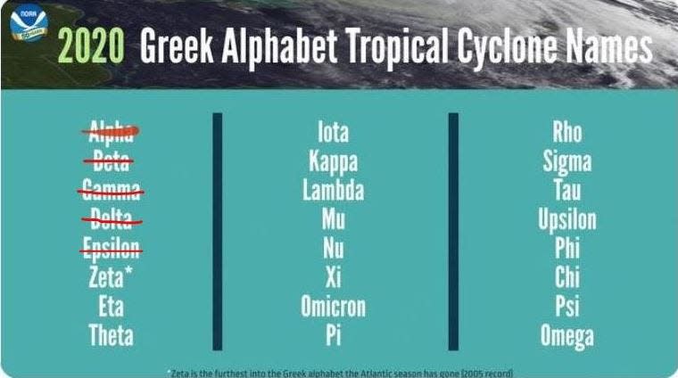
National Hurricane Center forecasters gave the system a 90% chance of development early Saturday. If the system becomes a tropical storm, it would be named Zeta.
Regardless of development, the National Weather Service is predicting wet days ahead for an already soaked South Florida and has a flood watch in effect through 8 p.m. Sunday.
But it depends on when and where something forms. With the disturbance being shallow, it's not feeling any direction from steering winds and is mostly just festering in place.

While Saturday could be hit or miss showers as tropical moisture floods north from the disturbance and a front pushes through the Panhandle, Sunday should see more downpours, according to the National Weather Service. Rain chances Saturday are just 30%, but increase to 70% in the evening. Sunday rain chances are 80%.
"I know people are getting tired of hearing that there is low confidence in the forecast because it's right on our doorstep," said NWS meteorologist Paxton Fell about the disturbance. "But it's hard to gauge because there are so many factors going on."
People also are tired of rain. Showers dropped 5.16 inches of rain at Palm Beach International Airport from Monday through Thursday.
Lawrence Simon, who lives in the Valencia Cove development west of Boynton Beach, posted photos to social media of the lake beyond his back yard rising. He said he hadn't seen it rain so much in such a short period of time since 2017's Hurricane Irma.
"The streets flow into the lakes and when the lakes are full the streets don't drain," said Simon. "There's a good 3 feet of water in the street. The garbage truck made it through, but cars are going to have problems."
Hurricane season lasts through Nov. 30, and the disturbance in the western Caribbean is finding a fertile environment for development this time of year with deeply warm water, low wind shear and high humidity.
The area for development shifted more into the Gulf of Mexico after waffling on Friday from the Bahamas to over South Florida. The system is forecast to drift north and northwest and move slowly across the southeastern Gulf of Mexico by Tuesday.
A NOAA Hurricane Hunter is scheduled to investigate the disturbance this afternoon.
"Any activity in the western Caribbean in October is cause for concern," said Brian McNoldy, a senior research associate for the University of Miami's Rosenstiel School of Marine and Atmospheric Science. "Some very notorious hurricanes have explosively developed here."
Follow Kimberly Miller on Twitter: @Kmillerweather.

This article originally appeared on Palm Beach Post: Is Tropical Storm Zeta forming? South Florida to get more rain

