
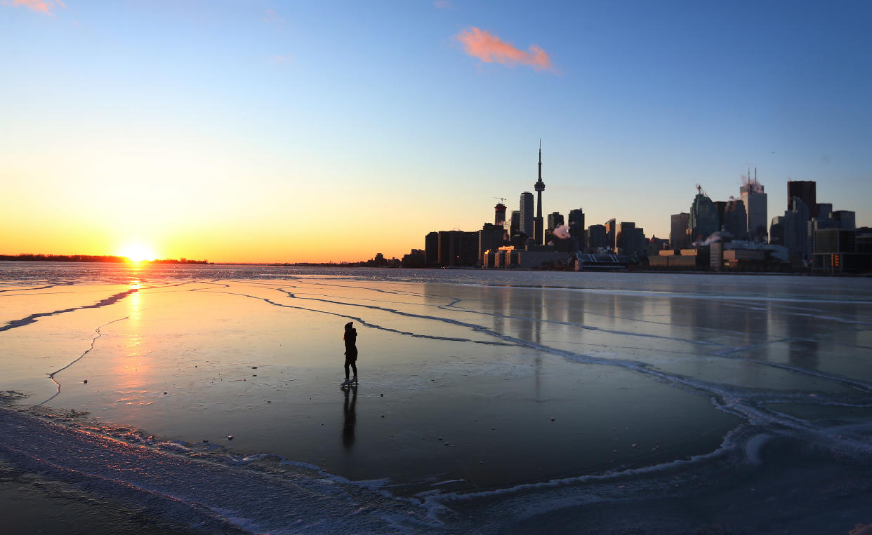
Canada heads into 'deep freeze': Severe weather forecast for both coasts
Rapid freezing and snowfall are in the forecast for much of Ontario, up through Quebec tomorrow.
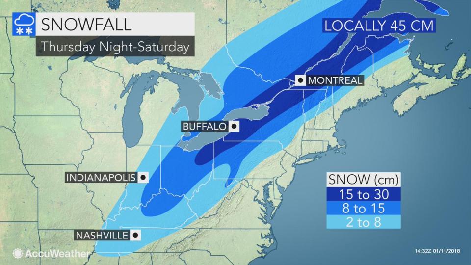
According to Brett Anderson, senior meteorologist with AccuWeather, initial forecasts predicted a major snowstorm in southern Ontario but in the last 36 hours or so, it looks like the heaviest snowfall is going to run from Ohio, through New York state and up into southern Quebec. Despite the change in the weather pattern, it looks like Ontario still won’t be spared from the snow as we approach the weekend.
“At this point we’re probably looking at anywhere from about 8 to 15 cm from Toronto, south through London and into the Hamilton area,” Anderson said.
The Ottawa area is expected to see a similar amount of snow but the AccuWeather’s meteorologist says that down towards St. Catharines, there could be enhanced snowfall from the winds coming off Lake Ontario, estimating 15 to as much as 25 cm of snow.
“You don’t have to go too far north and west of the greater Toronto area where it’s going to be more like 2 to 8 cm, it drops off really quickly,” Anderson said.
Despite the expected snowfall, Chris Scott, The Weather Network’s chief meteorologist, says that people in the Toronto or Ottawa regions should not expect a snow storm.
Southern Quebec on the other hand will see a heavier band of snow, particularly in the Montreal area, up through Quebec City, with 15 to 30 cm of snow expected, according to AccuWeather. The Weather Network is estimating similarly between 15 and 25 cm of snow in the region.
Rapid freeze
Before the snow starts to fall, a rapid freeze will occur as the temperature quickly drops, starting in northern Ontario and heading south.
Toronto will see temperatures averaging 5 C in the morning, cooling to -2 C around midday and then then dropping to -10 C by dinner time, according to AccuWeather.
“In the morning it’s going to be raining, it’s going to be fairly mild, and then the cold front comes through,” Anderson said. “Temperatures are going to steadily drop and in the Toronto area we’re probably going to drop below freezing just before lunch time, so that rain is going to change over to freezing rain, sleet.”
Anderson also points out that roads will get slippery quite quickly, with snow starting to fall around 3:00 p.m.
The Weather Network’s chief meteorologists says that at this point, the big question for tomorrow is how much this drop in temperatures will impact major roadways. Scott says that it is dependent on how much precipitation falls in the afternoon.
“The concern is even a couple centimeters of snow, if that happens around 3:00p.m. to 5:00p.m., is enough to makes things extremely icy, worse than what a normal couple centimeters would do,” Scott said. “It’s because the roads are warm from today and you’ve got some moisture still there, and then you put some snow on top of it, cars compacting it, then it gets colder still and you’ve got a very icy commute.
Scott indicates that if there is precipitation of snow or ice pellets in the afternoon, commuters should be weary of some very icy road conditions on certain roadways.
According to AccuWeather, as you move south towards London and Windsor, the same pattern of rain, rapid freeze, freezing rain and snow will occur but at a faster pace, likely earlier in the morning.

Possible flooding and power outages in the Maritimes
As this weather system moves east from Ontario and Quebec in to the Maritimes, Scott indicates that there is significant rainfall coming with the system that is moving through the area.
“Rainfall amounts will be an excess of 50mm and that may cause some localized flooding,” Scott says.
The Weather Network meteorologist also says that freezing rain is likely to makes its way through parts of central and northern New Brunswick on Saturday.
“This could be enough freezing rain to cause power outages, especially in places like Miramichi, New Brunswick, west towards Plaster Rock, Woodstock, New Brunswick,” Scott said. “We also have to watch the areas around Moncton and Fredricton depending on the exact track of that system.”

Frigid temperatures in the Prairies
As Ontario, Quebec and the Maritimes brace for rain, freezing rain or snow, the Prairies will be a bit drier but a lot colder.
“It’s certainly going to be very cold in the Prairies through Saturday and then another blast coming in later Sunday to Monday,” Anderson said. “But then it looks like it will warm up starting by the middle of next week across the region.”
“This shot of cold arctic air we’ve got now is the worst it’s going to be for the next seven to 10 days,” Scott said. “Generally if you can get through the next couple days then things start to turn around and we’re out of the worst of the deep freeze.”
According to AccuWeather, these two shots of arctic air should recover with temperatures near normal but there is potential for some light snow in the Prairies on Saturday, with possible snowfall in Alberta specifically next Wednesday.
Scott with The Weather Network indicates that there is a precipitation system in B.C. with heavy snow just above the sea level elevation, but he says that this system will likely miss the southern Prairies because it’s too cold.
“High pressure just blocks the moisture from coming in so we won’t really see much in the way of precipitation at all,” Scott says. “Outside of some light precipitation at time, we don’t see any significant storm systems on the horizon, most likely for the next seven to ten days.”

