
Chance of rain, strong storms forecast late Friday, early Saturday in Dallas-Fort Worth
Scattered thunderstorms may follow excessive heat that is on Friday searing Dallas-Fort Worth, according to the National Weather Service.
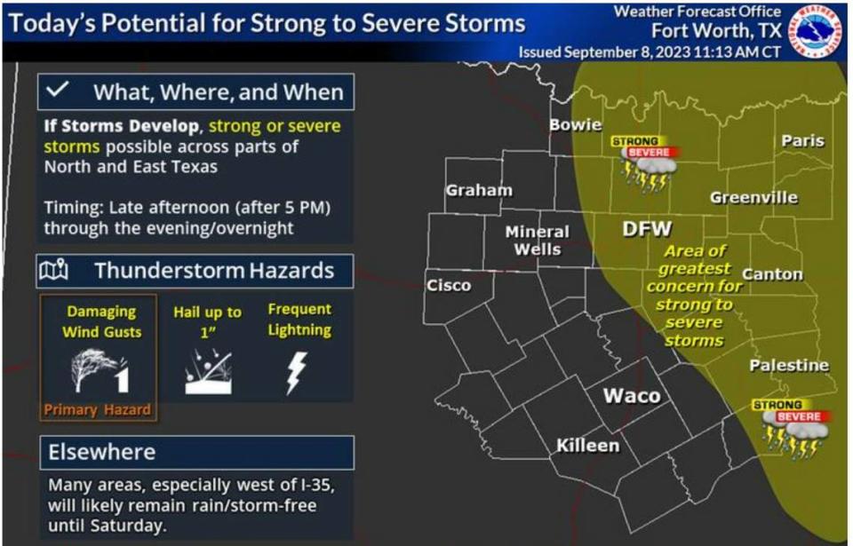
Storms are possible in Tarrant County on Friday afternoon and night. A few of the storms may be strong to severe. Damaging winds and large hail are their central threats, according to the weather service. The storm possibility is higher in East Texas than in North Texas.
The chance of showers and thunderstorms between 10 p.m. and 4 a.m. is slight. Skies are forecast to be partly cloudy.
The weather service forecast calls for a 30% chance of showers and thunderstorms on Saturday, mainly before 10 a.m. Skies are forecast to be mostly sunny and a high temperature is to be near 99 degrees.
Skies on Saturday night are forecast to be mostly clear, and the low temperature is to be about 77 degrees.
High temperatures are forecast between 100 and 105 degrees on Saturday for areas near and west of Interstate 35, according to the weather service.
Weather watches and warnings
A live data feed from the National Weather Service containing official weather warnings, watches, and advisory statements. Tap warning areas for more details. Sources: NOAA, National Weather Service, NOAA GeoPlatform and Esri.
Storm Reports
This map contains continuously updated storm reports and damage from the National Weather Service for the past 48 hours. Reports include tornado, wind storm and hail storm reports. The map also includes tornado reports for the past week and recent rainfall accumulations. Sources: National Oceanic and Atmospheric Administration (NOAA), Esri.

