
Climate change risk assessment at P.E.I. National Park aims to identify, mitigate risks
An assessment underway at P.E.I. National Park aims to identify risks that climate change poses to federally-owned transportation assets.
The two-year study is being funded by Transport Canada as part of a national program.
"At the the end of the two years, we're going to know where are the biggest risks to our roads and highway bridge here in P.E.I. National Park, that will allow us to do some future planning," said Bill Courtney, asset manager with Parks Canada.
"In sections, we may have to move the road in the future, so it'll give us time to do land acquisition if necessary and it'll give us time to arrange funding, to do a major multimillion-dollar relocation."

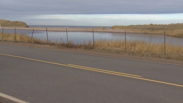
Courtney said the work is focused primarily on the Gulf Shore Parkway East, Gulf Shore Parkway West and Covehead Bridge, as well as some smaller roads.
"It's challenging here because we're trying to balance visitor experience with ecological integrity and integrity of the transportation assets," Courtney said.
"We want to bring people to the beach and to the coast, to experience everything that they can, but we also want to protect our investments and we don't want to do unnecessary damage to the environment."
On land, in water
An engineering company will collect data on land and in the ocean, until March 2021 — the work started in March 2019.
"In the ocean they're looking at water depths and long shore currents, tides, wave heights, water temperature," Courtney said.
"On land, they're looking at coastal erosion and how the dunes are changing over time."
The engineers are using an instrument called an acoustic Doppler current profiler, which sits in a tripod, a few hundred metres offshore, on the bottom of the ocean.
Courtney said it sits there for a month or two, then the data is collected and it's moved to another location.
This summer, the instrument gathered information in the waters off Dalvay, Cavendish, MacKenzies Brook, Orby Head and North Rustico, and that work will be repeated in 2020.

Courtney said Parks Canada had already been noticing differences as a result of changing weather patterns.
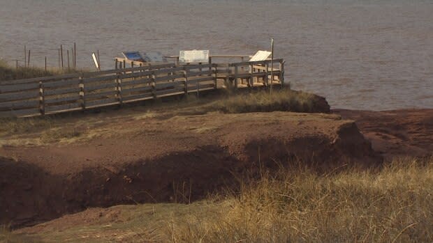
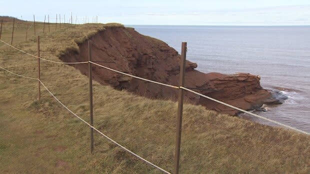
"I've seen quite a bit of erosion, especially in some significant storms in December of 2010. We had a multi-day storm that eroded two and three metres in some places," Courtney said.
"I've seen some assets that were close to the water being removed because they're just too close and they're compromised by coastal erosion."
Future planning
Courtney said the consultant will be looking at all options including armouring the shoreline or relocating the road.
"The consultants will give us some mitigation options, some cost estimates for what needs to be done," Courtney said.
"They'll also tell us when in the future might we need to do this — is it five years from now, 10 years from now, possibly 20 years from now."

Courtney said that will allow Parks Canada to do future planning for multimillion-dollar projects.
"You need to own the land and if you don't own the land, you need some years to allow for acquisition," Courtney said.
"You also need to arrange funding. Our field unit wouldn't have multimillion dollars available in a normal year to do this type of work."
The Transportation Assets Risk Assessment initiative is also funding a climate risk assessment of the Confederation Bridge — led by Transport Canada — and six ferry terminals in Atlantic Canada, including the ones at Wood Islands and Souris.
More P.E.I. news

