
Finding a patch of green: COVID-19 highlights inequities in Toronto park space, experts say
With summer taking hold in Toronto, many residents are flocking to the city's parks to escape the heat, enjoy the weather and catch up with friends — while adhering to physical distancing protocols amid the COVID-19 pandemic.
But the amount of nearby green space available to socialize safely can vary greatly depending on where you live in Toronto.
Most of the city's neighbourhoods with the least amount of park space per person are in and around the densely-populated downtown core, according to a CBC News spatial analysis. These are neighbourhoods where many residents live in condo or apartment buildings, and have little access to their own private green space.
As a result, experts told CBC News the pandemic is making existing inequities worse in terms of access to park space across Toronto, which can affect the mental and physical health of residents.
Here's what Toronto looks like if you break its neigbourhoods down by the amount of green space per person:
"Access to green space is really important," said Faisal Moola, who researches the effect of urban green space on public health outcomes.
"It helps to reduce stress, it helps to promote physical activity, it even helps to filter out air pollutants."
During the summer, the University of Guelph professor says Toronto's parks are also an important refuge from the heat for the homeless and for those who live in apartments without air conditioning.
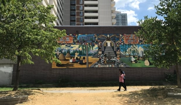
North St. James Town has least park space per capita
Respite from the heat might be harder to come by in North St. James Town.
The densely-populated area has the least amount of park space per capita of any neighbourhood in the city with less than one square metre per person, according to the CBC News analysis.
Census data from 2016 shows that 90 per cent of residents in that community live in apartment buildings, 40 per cent live in poverty, and more than half identify as immigrants.

"They suffer from some of the socioeconomic factors that are associated with poor health — namely poverty — and they also suffer from the fact that they have a lack of access to green space in close proximity to where they live," said Moola.
As a result, the professor says the city should be "focusing greening activities in lower income communities, in racialized communities, and that obviously means creating more parks, more parkettes."
Two new projects are in the works in North St. James Town to help add more green space, according to the city's director of parks development and capital projects.
Ann-Marie Nasr told CBC News she's in the process of securing a new park and she's partnering with Toronto Community Housing to convert an open space above one of the public housing provider's underground parking garages.
"What we're looking at is an opportunity to connect the laneways and to create more of a park-like setting on top of that renovated underground parking garage," said Nasr.
"What we're doing with [North St. James Town] in particular is making sure that we secure onsite parkland and also basically re-imagining the assets that we have, the open space assets that we have and improving them as park."
Nearly 40 Toronto neighbourhoods have 'low park provision'
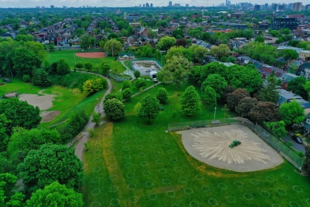
Toronto's parks system covers 13 per cent of the city's land, with more than 1,500 named parks, according to the city's Parkland Strategy, which was adopted by city council last fall.
The long-term parks planning framework defined areas with low park provision as those that have less than 12 square metres of park space per person. For comparison, the size of a standard parking space is about 15 square metres.
Nearly 40 of Toronto's 140 neighbourhoods fall below that threshold, according to a CBC News analysis. Examples of those neighbourhoods include The Danforth, Little Portugal, the Annex and Kensington-Chinatown.
Nasr says two factors are at play in terms of areas with low park provision. First, parkland wasn't historically part of the plan when the communities were built, and second, there's been huge population growth across the city, especially downtown.
"People are using parks as an extension of the daily living space, because 90 per cent of the city's growth is happening through condominiums that are high-rise," she said. "So having that extension and having that space is really important for quality of life."
As a result, Nasr says her team is trying to secure new parkland as development comes forward and is working to improve existing parkland, as well as access to it.
The Parkland Strategy also flagged that small parkettes account for 39 per cent of the total number of parks in Toronto but just one per cent of the park area. Meanwhile, legacy parks — like High Park and Trinity Bellwoods — account for only 10 per cent of the total number, but cover 76 per cent of the total park area.
So there are many neighbourhoods that don't have easy access to those larger parks.
"Our larger parks have always been the ones that do the heavy lifting," said Nasr. "We need larger parks and we need to expand our existing parks."
That's why, she says, the city has worked to revitalize Queen's Park North and has updated St. James Park.
Short-term solution: plant 10 more trees per city block
In the short-term, Moola's research has found that improving green space in an area can be as simple as planting more trees.
"Just by planting 10 more trees per city block, we actually can reduce cardiovascular disease, respiratory disease, and the rates of depression quite significantly," he said.
"Because people are then interacting with much more green space on their day, as they move around the neighborhood."
Nadha Hassen, a PhD student at York University, says the city can also improve on the quality of the park space already in place, because quality is often more important than quantity in terms of mental health.
"COVID-19 really has highlighted the inequities between our neighbourhoods, and exacerbated some of those inequities," Hassen told CBC News.
Quality of park space matters
"Simply having green space, and even a significant amount of green space, isn't sufficient for us to start to understand the impacts on mental health and well-being, especially when it comes to depression and anxiety, which is rising during COVID-19."
In her research, Hassen has found that some lower income neighbourhoods in Toronto with a higher amount of green space actually have lower self-reported levels of mental health.

Hassen is now trying to unpack why that is, but says it likely has to do with how safe and comfortable, or uncomfortable, people feel in the parks around them. She says the city needs to reach out and listen to the concerns of marginalized residents in order to make parks in their neighbourhoods safer.
All of these efforts are all the more urgent right now with the need for people to get outside safely during COVID-19, according Claire Nelischer of the Ryerson City Building Institute.
Time to get creative
"It's really important that in the next few months as Toronto shifts from the immediate COVID recovery towards more rebuilding that we think about how we can invest in our existing park spaces and make them work better for how people are using them today," she told CBC News.
Nelischer thinks programs like ActiveTO, which has opened up streets for pedestrians and cyclists, are creative and encouraging steps in the right direction.
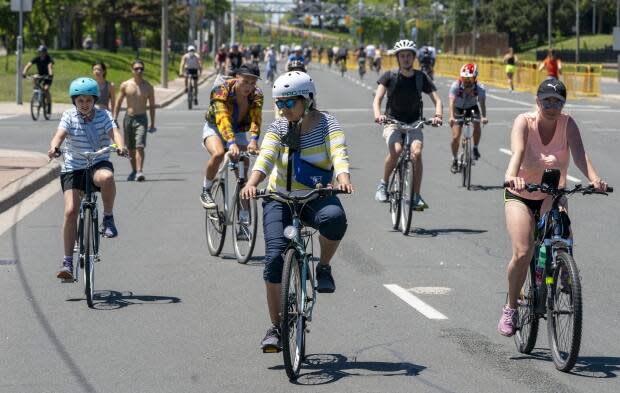
"They are recognizing an existing need for safe space for active recreation and play and that streets can be an important site for that," said Nelischer.
"That's a good example of recognizing a need and responding to it with a temporary planning solution."
Nelischer is looking for more of that kind of creativity from the city in the coming months.
"We don't have timelines that we can wait five or 10 years for a new park to be built; we need to work with what we've got right now."
METHODOLOGY: HOW DID CBC ANALYZE THIS DATA? CBC used spatial analysis software to calculate the surface covered by public green areas in Toronto neighbourhoods and then translated that figure into a per capita rate and a percentage. We used shapefiles representing boundaries of the parks and neighbourhoods as provided by the City of Toronto Open Data Portal on June 15. The demographic information, such as the number of residents per neighbourhood, is based on the 2016 Census Population data from Statistics Canada.

