
Fire danger down in some areas of N.W.T., but officials urge vigilance
Heat warnings have ended for communities in the N.W.T. and fire danger forecasts have started to drop in some areas, but fire officials say people should still avoid having fires unless absolutely necessary.
Environment and Climate Change Canada is predicting rainy conditions for most areas of the territory today, and several regions saw rain fall over the weekend.
Despite that, Mike Westwick, a wildfire information officer with the Department of Environment and Natural Resources, said residents still need to be "really, really careful," especially if they live in areas where the fire danger remains high or extreme.
"It's very natural for folks to sort of overestimate the difference that rain can make," he said. "With the exception of the South Slave region, there's still monitoring stations in every single region that are showing high or extreme (danger)."
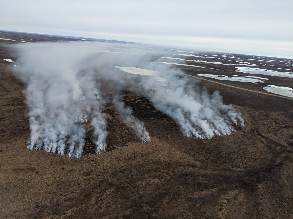
The department's latest wildfire data showed 113 wildfires burning in the N.W.T. as of Monday evening. In total, 328,370 hectares have burned so far this year.
Fire danger remains high or extreme today in the Beaufort Delta and Sahtu regions, and in some areas of the North Slave and Dehcho.
The wildfire south of Wrigley grew to 21,873 hectares over the weekend, roughly doubling in size, but Westwick said there is still no immediate risk to the community.
He said 20 firefighters from Saskatchewan have been helping to fight that fire, and controlled burning on that fire has been successful so far. That work continues today.
"It's going to extend the line of defence to an old, burnt forest area where there's less chance for a fire to grow," he said.
Highway 1 south of Wrigley and the Mackenzie River/N'dulee ferry are both currently open, but that could change quickly.
Over the weekend, Pehdzeh Ki First Nation Chief Lloyd Moses told CBC News they have a camp with cabins and tents set up on the other side of the Mackenzie River in case they need to evacuate.
Another fire of note sparked less than two kilometres off the Ingraham Trail last night, about eight kilometres north of Jennejohn Lake.
Westwick said that fire is less than a hectare in size and a fire crew was on it right away.
Smoke advisory
The territory issued a smoke advisory for some N.W.T. regions and communities. They include the North Slave, south Beaufort Delta region, Thebacha, Colville Lake, Deline, Fort Resolution including Hwy. 6, Lutsel K'e, Norman Wells to Tulita, and Tuktoyaktuk to the East Channel region.
The territory said the amount of smoke may change with weather conditions. The territory issued a smoke advisory last week for the Yellowknife area.
People who are physically active outdoors, including outdoor workers, may be most likely to be exposed. Smoke can cause sore eyes, tears, coughing and a runny nose. People at higher risk of severe health impacts — including young children, elderly people, people with diabetes, lung, or heart conditions, and pregnant people — should consider staying indoors.
Those experiencing serious symptoms such as wheezing, chest discomfort, or shortness of breath, should call their local health centre.

