
Fire-hazard reports find multiple N.S. communities at extreme risk, but most residents don't know it
Cassandra and Ted Parisee spend a lot of time thinking about the beauty — and danger — of the dense woods surrounding their Beaver Bank community just outside Halifax.
The couple manage community access to private woodlot land where they have come across burned trees and old campfire sites, even though tenting and starting fires in the area are banned.
Although Cassandra said they love living so close to nature, the recent Upper Tantallon wildfire has been a sobering reminder of how quickly fire can get out of hand in a suburb at the forest edge.
"If it was to happen out here … our homes would probably be the first ones to go. So it's scary," Cassandra said.
The Parisees didn't know it, but the province assessed the Beaver Bank/Kinsac area for fire risk years ago and found that "the majority" of the community was ranked high to extreme for wildfire risk due to the makeup of the homes, nearby woods, limited road access and its water supply.
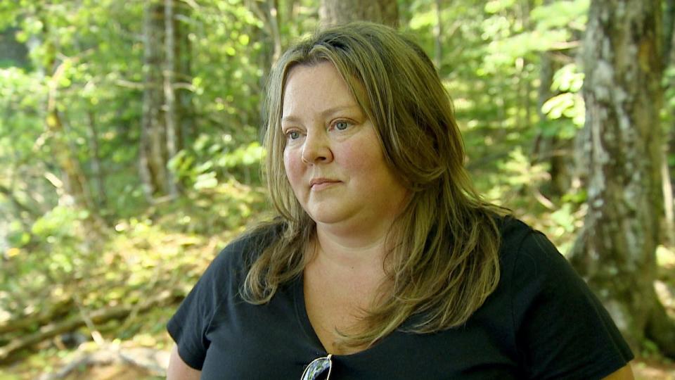
Cassandra Parisee is a Beaver Bank resident who also manages community access to Barret Lumber Company land through the Lakeland Gate Association. (CBC)
"A higher [forest] content of softwoods that are dead and dying, create an extreme risk based on their flammability and fuel loading," the report found. "Older home construction or home construction of combustible materials, age, and proximity of the fuels to the homes make it an extreme risk of fire spread.
"These areas also represent a high life threat based on access and population, response times by fire personnel and inadequate resources for fire suppression."
For at least 10 years, the provincial Department of Natural Resources and Renewables has been assessing communities for fire risk — but the results aren't always getting to the people who would be most affected.
Nine assessments completed so far
Beaver Bank's report is one of nine assessments completed around the province as of July, while 12 other communities have started the process.
CBC News has made all of the assessments publicly available, and can be viewed by clicking the links for below.
Five assessments are within the Halifax municipality: Westwood Hills,Beaver Bank, Hatchet Lake, Kelly Point in Prospect and Shag End near Blind Bay. The remaining four are in Lunenburg County: The Pointe on the Aspotogan peninsula, Masons Point, Sherbrooke Lake and Tancook Island.
Many other communities have hosted public information sessions about fire risks, like Chester Basin's annual event, while multiple First Nation communities in Nova Scotia have also been assessed.
Lisa Blackburn represents Beaver Bank on the Halifax Regional Municipality council. She said she's been aware of the assessment for some time, but doesn't think most of her residents have seen it — and that's "definitely a gap."
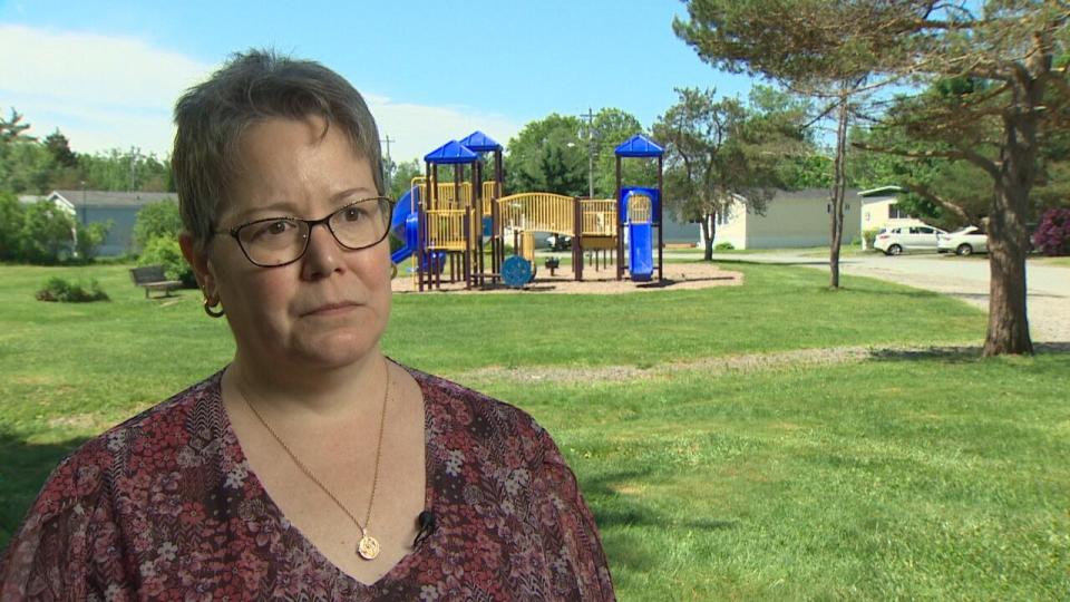
Lisa Blackburn represents Middle/Upper Sackville-Beaver Bank-Lucasville on Halifax Regional Council. (CBC)
"The fewer people that know about these things, the more chance there is that these reports will just sit on a shelf and collect dust," Blackburn said.
She added that since the May wildfire, many residents have told her they're worried about how they'd safely evacuate in any emergency.
Dramatic floods in Nova Scotia that followed this summer's fires are another example of an extreme weather event that can threaten communities.
"We are in a semi-rural area and nature will always win. So it's something that I think we've always accepted, but I think now is the time to start better preparing for nature," Blackburn said.
Kara McCurdy is the lone wildfire prevention officer for the Department of Natural Resources and Renewables and author of all of the assessments which are based on FireSmart standards. FireSmart Canada is a national program that recommends ways to minimize the risks of wildfire including creating buffer zones around homes and using fire-resistant plants.
In Beaver Bank's case, McCurdy said the assessment was originally requested by the local volunteer fire chief. It went back to the station and the city, so it wasn't shared widely with neighbourhood groups.
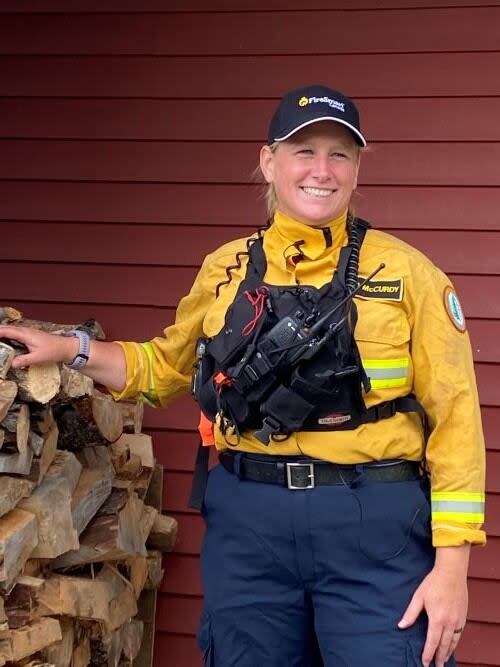
Kara McCurdy is the wildfire prevention officer for Nova Scotia's Department of Natural Resources and Renewables (Kara McCurdy)
While the older format of the assessments was more like a scoring card — Hatchet Lake and Masons Point are examples, both hitting numbers showing extreme risk — McCurdy said the recent ones detail any issues around housing materials, geography and water access, paired with recommendations and action plan.
Once the reports are assembled, McCurdy said they are sent to whoever requested them. Often that's a resident association, fire department, or maybe municipal staff — and McCurdy said it's up to those groups whether they share the reports widely.
"The hard part with all of this planning and assessments is keeping all the residents in the loop of everything and that's the part that we've got to continually do because there's constantly new people moving in," McCurdy said.
When asked about whether there could be a more formal process where the assessments go to the corresponding municipality and MLA, so key structural improvements aren't lost in the shuffle, McCurdy said that would "be difficult."
Province working on risk map
There are so many groups involved in the assessments, she said, and her team already makes sure to bring pressing issues to those involved — like Nova Scotia Power for risks around their infrastructure, or local fire departments.
"It is kind of a roundabout way to do it. You know, when you think of it, it'd be nice to have all this in place when the community is developed, period," McCurdy said.
"And we're working on that, you know, getting more of the community development planning side of things involved."
The province is working to develop a fire "risk map" of Nova Scotia, McCurdy said, which would allow them to focus education materials in those communities, "but that's going to take some time to do."
Residents in assessed communities have often been passionate about safety, McCurdy said, and respond by clearing brush and creating buffers around their homes.
"I try to be as honest as possible and I don't sugarcoat it, you know — this is what can happen," McCurdy said. "And you take that risk if you don't do any work."
But her assessments also flag structural issues only governments can address, like emergency road access. And there's no timeline for change built into the reports.
Of the nine completed assessments, eight make specific mention of high or extreme fire risks within the communities, including The Pointe on the Aspotogan peninsula. It was requested by the local residents' association.
The land is owned by a mix of seasonal residents from the United States and permanent residents, according to the November 2022 assessment, and is located in Lunenburg County between Hubbards and Chester.
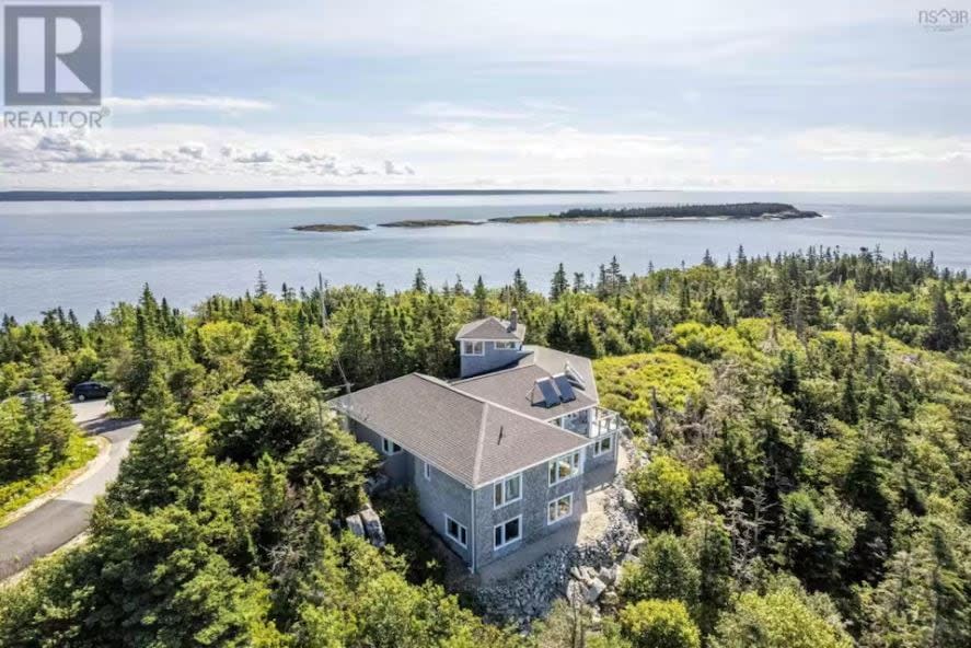
Multiple listings of homes for sale on the Aspotogan peninsula, like this one on White Point Run, show how forest completely surrounds the lot. (ReMax)
The assessment said there's dying forest in the area, high-risk tree species, poor soil, and coastal winds, leading to "extreme fire intensity potential." It also said that while the area is surrounded by rocks and ocean, there's little easy access to water besides one dry hydrant.
A dry fire hydrant is linked to a body of water rather than a municipal water system.
Chief Michael Schnare of the volunteer Blandford and Area Fire Rescue said he's long been aware of the risk in that area and mapped out various strategies to get into the "twisty and narrow" roads, according to the report.
It would take their crew at least 20 minutes on a good day to get to the Pointe, Schnare said, and even with help from neighbouring stations it would take a while to set up hoses that could reach homes.
"Everything we'd do is just hard, and it is definitely a concern to us," Schnare said.
Since the recent wildfires, McCurdy said about 10 new communities requested assessments. She's also recently been in Cape Breton training firefighters on wildfire prevention and assessing areas on the island, which are now at higher risk given all the trees blown down almost a year ago by post-tropical storm Fiona.
Anyone interested in a community assessment can contact the department, McCurdy said, and go through the FireSmart program to ensure their property is as protected as possible. For those in the Halifax municipality, Halifax Fire is offering free assessments for individual homeowners.
MORE TOP STORIES

