
Stubborn atmospheric river lingers over B.C., elevated flood and avalanche risk
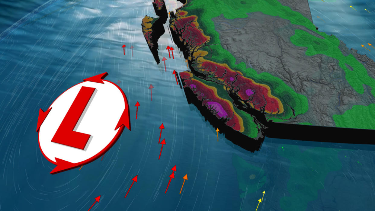
We’re stuck in a very wet pattern along the West Coast as a stubborn atmospheric river lingers over the region for the beginning of the week.
This Pineapple Express event will continue to fuel rounds of heavy rainfall across Vancouver Island and the South Coast over the next couple of days.
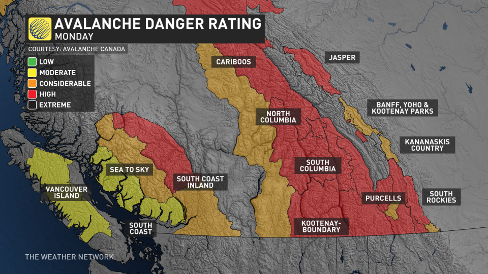
A risk for flooding will continue as heavy rain and snowmelt occur across the region. There’s also a high risk for avalanches as freezing levels rise.
DON’T MISS: El Niño is hanging strong—but a big change is on the way
Monday
Downpours that began this weekend will continue into the beginning of the workweek as a steady stream of tropical moisture funnels into the coast.
Initial rainfall reports from the first round trickled in on Sunday. Parts of Metro Vancouver saw more than 50 mm of rain. Vancouver Airport saw about 40 mm of rain, making for its wettest January day since Jan. 3, 2019.
RELATED: Backcountry enthusiasts beware as weather warms, experts cite avalanche risk
The hazard with this setup is that the atmospheric river isn’t really moving anywhere. It’ll remain in place and fuel heavy rain across southwestern B.C. through early Tuesday before the ribbon of moisture begins slumping southeast.
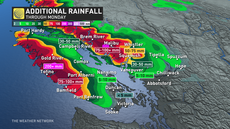
By the time the rain wraps up, we’re likely to see rainfall totals amounting to more than 200 mm across the higher terrain along western Vancouver Island. Other regions that could accumulate excessive rainfall include the Sea-to-Sky Corridor, where up to 150 mm is predicted through Tuesday afternoon.
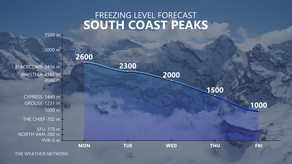
High freezing levels are concerning. This deep reserve of mild, tropical air is bad news for ski resorts along the North Shore and Vancouver Island, where freezing levels will jump higher than 2500 m through the middle of the week.
Combined rainfall and snowmelt will lead to a flooding risk around the mountains, as well as creating an unstable snowpack that will enhance the potential for avalanches in the backcountry, to considerable levels in many areas, along with mudslides.
MUST SEE: Get ahead of disaster: Six tips to manage flooding
Widespread flood watches and high streamflow advisories are in effect across southwestern B.C., with a flood warning issued on Sunday for the Sumas River in the Lower Fraser Valley.
WATCH: A parade of storms creates dangerous conditions in British Columbia
Remain mindful of the risk for flooding around vulnerable low-lying areas, and avoid driving across flooded roadways if you come across high water. It’s impossible to tell how deep the water is until it’s too late, and the road may have been washed out beneath the water.
The strong and mild southwest flow mean temperatures on Monday will be in the low teens across southern Vancouver Island and Metro Vancouver, up to 10 degrees above seasonal. A couple of stations may record temperatures as warm at 15 or 16°C –– making it one of the warmest January days on record across Metro Vancouver.
Record-breaking temperatures are forecast to remain in place Tuesday.
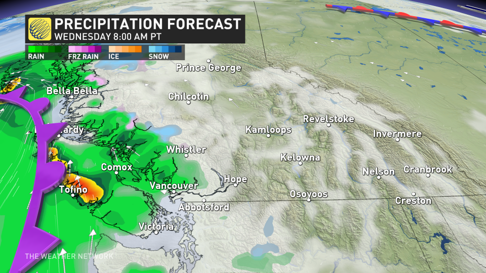
Tuesday into Wednesday
Tuesday will see a much needed break from the rainfall, but another round of soggy weather will impact very similar areas by Wednesday.
This round looks weaker and more disorganized, but similar hazards will be felt since the ground and alpines are so unstable from the weekend.
Drier, and more seasonal conditions will follow into the weekend.

