
Google's color-coded map shows where COVID-19 cases are spiking
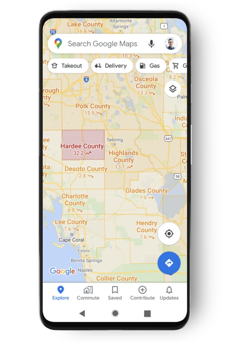
Google Maps has a mapping layer that allows users to see regions color-coded by per-capita number of COVID-19 cases.
The feature aims to help users "make more informed decisions about where to go and what to do."
The COVID-19 layer is available to iOS and Android users and online.
Google has a feature that allows users to view COVID-19 case numbers as a layer in Google maps, which can help users see the high-transmission areas where the Centers for Disease Control has recommended wearing masks. The layer color codes areas by the 7-day average for the number of new cases per 100,000 people, and shows if cases are trending up or down.
The layering feature, which was released in September 2020, may be becoming even more relevant as COVID-19 cases spike across the country and the Delta variant surges.
The goal of the feature is to help users "make more informed decisions about where to go and what to do," wrote Sujoy Banerjee, a product manager at Google, in a blog post.
The move isn't Google's first effort to release features tailored to life amid the COVID-19 pandemic. In June, 2020, Google released a number of features, including transit alerts that ping users when government mandates impact service or if there's a mask requirement on board. Google also introduced driving alerts that notify users about COVID-19 checkpoints when travelling. And for those looking to avoid crowded train cars, Google also made it easier to access live data on the business of stations.
Competitors like Bing and Apple have also worked on pandemic-oriented mapping tools. Bing runs a live COVID-19 tracker with global case data. And in April, 2020, both Google and competitor Apple added COVID-19 testing sites to their map platforms. Apple also last year began making aggregated mobility data available to help governments and health authorities make policies.
In addition to Google Maps' country-level data in 220 countries and territories, there's also state, county, and city level where data is available. Google says it sources the COVID-19 data from Johns Hopkins, the New York Times, and Wikipedia.
Users can activate the COVID-19 layer on their mobile device by opening Google maps on their phone, tapping the layer button, and selecting COVID-19 info.
Read the original article on Business Insider

