
Persistent storm potential on the Prairies amid hot, humid air mass
An Omega blocking pattern over Canada will keep the Prairies locked in its current state of scorching heat and stifling humidity.
In combination with a boundary over the region, the hot, humid air mass could trigger more severe thunderstorms across the Prairies Wednesday. While the seemingly endless bouts of severe weather may be tiring, it’s important to not become nonchalant when it comes to monitoring your local weather and alerts.
RELATED: This ‘Omega block’ will dominate Canada’s weather this week
STAY SAFE: Stuck in your car during a tornado? Here’s what you should do
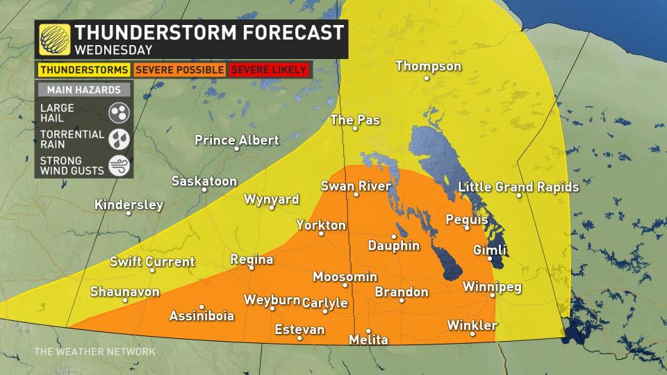
Wednesday
Areas: Southern Saskatchewan, central and southern Manitoba
Weather: The slow-moving front will bring another day of active weather to the eastern Prairies, with similar hazards possible within severe thunderstorms that develop. Cities like Brandon and Winnipeg should be on alert for thunderstorms through the day.
Break from the storms ahead
By Thursday and Friday, the storm risk will diminish across the majority of the Prairie provinces, with the exception of the extreme southern communities right along the international border. High pressure from the north will force stable air across the region.

The ridge of high pressure building back in will focus the hottest temperatures across the northern Prairies and Canada’s far north. Daytime high temperatures of 30°C will return to northern Alberta and Saskatchewan Friday and into the weekend.
Thumbnail image courtesy: Bob Ledoux, taken in Winnipeg, Man.
Keep checking back to The Weather Network for more forecast information and updates across the Prairies.

