
Here are the latest flood-related road closures and detours
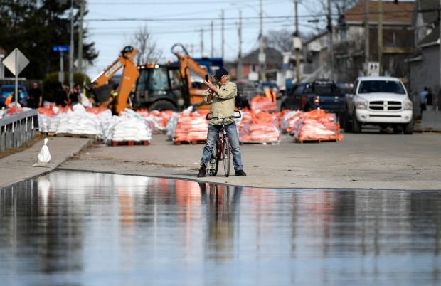
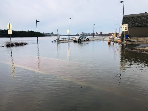
Rising waters have closed or reduced the capacity of several streets and highways in the Ottawa-Gatineau area.
Here's a list of some of the roads affected by flooding as of 8 a.m. Friday.
Officials are warning people to take care when driving through any standing or moving water as conditions can change rapidly.
Road closures in Ottawa
March Valley Road is closed from Cameron Harvey Drive to Klondike Road.
Vances Side Road is closed from Torbolton Ridge Road to Woodkilton Road.
Mohrs Road is closed from Galetta Side Road to Riddledale Road.
Trim Road is closed at Jeanne D'Arc Boulevard.
Grandview Road is closed at Carling Avenue.
Road closures in the Cumberland area
Boisé Lane is closed.
The northern ends of Armstrong and Morin roads are closed.
Leo Lane is closed.
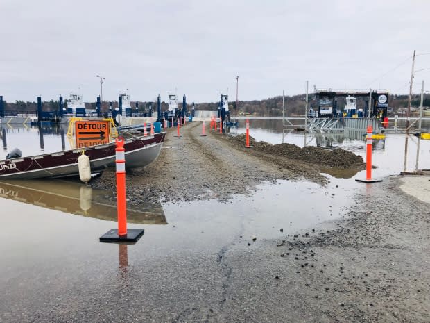
The Ecolos ferry between Rockland and Thurso and the Bourbonnais ferry between Masson-Angers and Cumberland are not running because of the flooding.
Road closures in Gatineau
The Quebec Ministry of Transportation is closing all the on and off-ramps from Highway 50 to rue Saint-Louis, with a detour along boulevard de la Gappe.
The highway is also down to two lanes in each direction between Highway 5 and the Des Draveurs bridge.
The Alonzo-Wright Bridge between boulevard la Vérendrye and Highway 105 is dedicated to only westbound traffic until 9:30 a.m. Friday.
Drivers are asked to slow down on boulevard Fournier, where crews are working on the side of the road ahead of Friday's rain and only one lane is open in each direction.
Pointe-Gatineau
Rue Saint-Louis is closed between Highway 50 and rue Moreau.
Rue Moreau is closed from Saint-Louis to rue Donald-Saint-Jacques.
Rue René.
Rue Blais.
Rue Ernest-Charron.
Rue Saint-François-Xavier.
Rue Oscar.
Rue Adélard.
Rue Corriveau.
Rue Carmen.
Rue Jacques-Cartier is closed from Saint-Louis to rue Montgolfières; another smaller stretch is closed further west from Moreau to rue Joseph-Bélanger.
Lac Beauchamp
Rue Riviera.
Rue Saint-Saveur.
Most of rue Campeau.
Rue Glaude south of rue Saint-Saveur.
Rues Saint-Patrice and Saint-Paul between Saint-Saveur and Riviera.
Rue de Versailles and rue Sabourin between rue Watt and boulevard Hurtubise.
Boulevard Hurtubise.
Masson-Angers
Chemin du Fer-à-cheval.
Rue du Ruisseau south of rue Lasalle.
Rue Sanscartier south of rue Plouffe.
The southern end of chemin du Quai at the ferry teminal.
Aylmer
Rue Lamoureux west of rue Dorion.
Roads in Gatineau restricted to local traffic only
Rue Saint-Louis between rue de Picardie and boulevard de la Gappe.
Rue Jacques-Cartier between rue de la Baie to Montgolfières.
Boulevard de la Gappe south of rue Carmen.
Rue Oxford.
Rue Moreau between rue Donald-Saint-Jacques and rue de Pointe-Gatineau.
Rues Saint-Patrice, Saint-Paul and Glaude between Saint-Denis and Saint-Sauveur.
Rue Saint-Denis.
Rue Notre-Dame between bouevard Labrosse and rue de Verchères.
Rue de Vimy.
Chemin Fraser south of rue de Minervois
The city's flood page has an interactive map.
Road closures in western Quebec
Pontiac:
Chemin Rivière between chemin Mulligan and Highway 148.
Chemin Cain.
Chemin du Lac LaPêche.
Saint-André-Avellin:
The bridge over the Petite-Nation River on rue Principale, part of Highway 321, is closed.
Highway 17 washout
Highway 17 is closed to most traffic in both directions between the communities of Deep River and Mattawa after part of the highway washed out early Monday morning.
The stretch from Deep River to Bissett Creek is open to local traffic only.
Ontario Provincial Police have set up detours in both directions that will take drivers through Algonquin Park.