
March madness: Last month was colder and snowier than usual
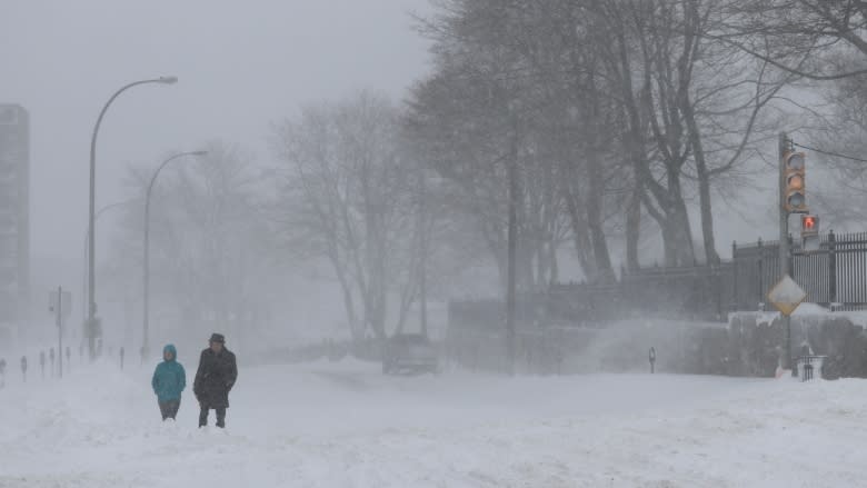
Have the impression that this past March was colder and featured more of the white stuff than usual? You'd be right!
Most weather observation stations finished the month with mean daily temperatures well below climate normals and snowfall amounts well above.
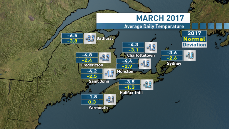
Temperatures in the province finished a good one to two degrees below 30-year climate norms for the month, which doesn't sound like much but is significant given the data is averaged out over 31 days.
Standouts include the Halifax Stanfield International Airport where the mean temperature of –3.5 C was the eighth coldest for a March on record going back to 1961.
Yarmouth and Greenwood were also chilly with the 12th coldest March on record back to 1880 at –1.8 C and the 13th coldest March on record back to 1943 at –2.5 C, respectively.
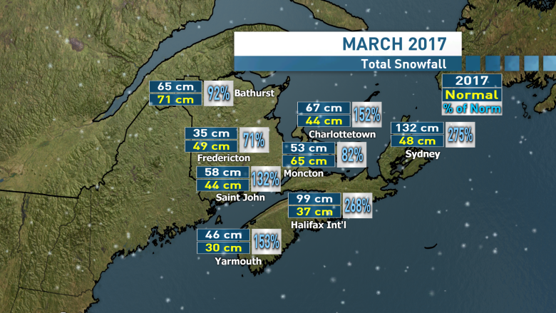
Snow-shovelling muscles also got a workout in the province last month; both Halifax and Sydney received more than twice as much snow as the March normal.
The Halifax airport tied for second snowiest March on record with 98.8 centimetres of snow only topped by the notorious March of 2015 when 146.7 centimetres came down.
Catching the worst of the past few storms, Sydney finished last month with 132.1 centimetres of fallen snow, good for the fifth snowiest on record going back to 1870. That's very impressive considering that's fifth out of 147 years.
The colder month broke a streak of above normal temperatures that ran through the past winter season.
Climatological forecast models run by Environment Canada are calling for near normal temperatures over the next three months with the exception of the southwest of the province which is expected to experience above normal temperatures.
Those same computer projections are calling for near normal amounts of precipitation April through June.
