Much of GA in storm’s crosshairs as Hurricane Idalia roars ashore. Here’s the latest forecast
Powerful Hurricane Idalia was on a collision course with a huge swath of southern and Middle Georgia on Wednesday as it plowed ashore along north Florida’s Gulf Coast.
Hurricane warnings were issued for vast areas south and near a line stretching from Valdosta to Savannah, while rare tropical storm warnings reached far inland along an arc roughly from Albany to Macon and Warner Robins on over toward Milledgeville and Augusta.
In a predawn alert, the National Weather Service said tropical storm-force winds, up to 57 mph, were possible in parts of the midstate. Downed trees and electrical outages are likely as trees and limbs clip power lines. Flooding and tornadoes are also possible.
Idalia had been expected to veer more easterly toward Jacksonville, Florida, and Brunswick early in the week. But forecasters in Georgia warned that even slight westerly jogs in the storm’s course as it trawled the warm waters of the Gulf could send it hurtling on a path into the Peach State’s midsection.
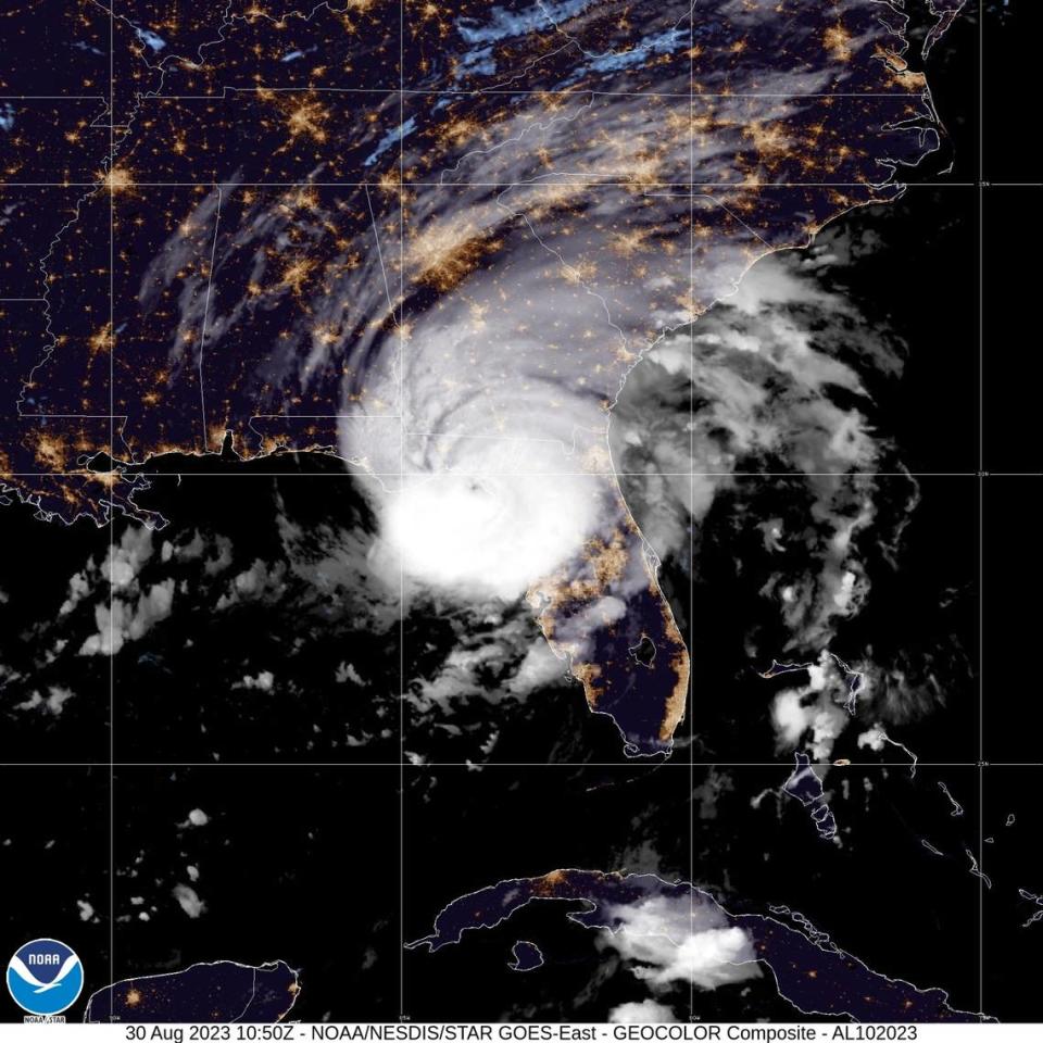
Packing 125-mph winds, it was the strongest storm on record to strike a direct hit to Florida’s so-called Big Bend region when barreled onto land shortly before 8 a.m. Wednesday.
Landfall came near Keaton Beach, a fishing town 200 miles due south of Macon.
A couple of hours later, Idalia’s eye motored toward south Georgia’s Interstate 75 corridor and the Valdosta area, whipping up gusts of nearly 60 mph as it angled to the northeast.
The weather service on Wednesday said the heaviest rain would likely come there, in deep southeast Georgia, where from 6 to 8 inches could fall.
Forecasters in the weather service’s Peachtree City office said impacts from Idalia, a fast-moving and major Category 4 storm, “will begin to increase appreciably across our southeastern counties beginning mid to late morning as the northern extent of the rain shield arrives and northeasterly winds begin to increase.”
Wind gusts to 40 mph and 1-to-3 inches of rainfall were more likely in Middle Georgia locations.
“A final threat will be isolated tornadoes in the far southeast within the outer bands of Idalia,” the weather service noted. “Fortunately, Idalia is a fast-moving storm and will be shunted eastward as a surface cold front pushes southward into north Georgia.”
Weather service meteorologist Katie Martin said Idalia’s westward shift would not veer far enough toward Alabama to bring major impacts to the Columbus area.
“Tropical storm warnings are to the east,” Martin said. “Columbus will see wind gusts of 25 mph, maybe occasional gusts around 30 mph.”
— Climate change reporter Kala Hunter of the Ledger-Enquirer in Columbus, Ga., contributed to this article.