
Storm surge hits coast along northern and northeast N.B.
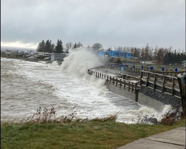
High waves smashed into the northern New Brunswick coast on Monday afternoon after a strong, low pressure system moved into the Maritimes.
Strong winds and heavy precipitation were was in the forecast — snow for the north and northeast and rain for much of the rest of the province.
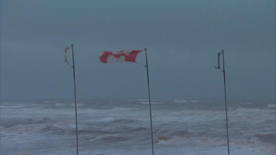
High winds battered the Acadian Peninsula on Monday afternoon. (Pascal Raiche-Nogue/Radio-Canada)
Environment Canada warned a storm surge and large waves would coincide with high tide around 4 p.m. for Campbellton, Miscou Island and Bas-Caraquet.
Eel River Bar First Nation announced around 2 p.m. that Bar Stretch Road was closed until further notice because of sea swells.
But things weren't too bad in the Dalhousie area, according to Normand Pelletier, the mayor of Heron Bay, which includes Dalhousie. He said he was expecting a worse storm than what the area got.
"I was praying that it's not so bad, and so far our prayers must have been answered," Pelletier said.
"There will be debris to clean up tomorrow on the coastal roads, but where I live, everything is a-OK."
Environment Canada snowfall warnings were in place for the western half of Restigouche County and the Edmundston region.
CBC meteorologist Tina Simpkin said up to 15 centimetres of snow could fall in the north.
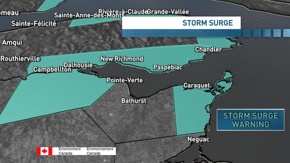
CBC meteorologist Tina Simpkin said east-facing coastlines of the Acadian Peninsula and western and northern coastlines of the Bay of Chaleur could see a storm surge near high tide around 4 p.m. (Tina Simpkin/CBC)
Simpkin said east-facing coastlines of the Acadian Peninsula and western and northern coastlines of the Bay of Chaleur could see a storm surge near high tide around 4 p.m.
Coastal flooding, beach erosion and road washouts were all possibilities.
Newfoundland and Labrador and Nova Scotia also had weather warnings in place, particularly for wind and rain.

