
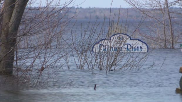
Ottawa River levels starting to fall again
The Ottawa River's second round with flood-weary residents appears to be coming to an end as floodwaters again began to recede.
The Ottawa River Regulation Planning Board released new numbers Monday showing the river is starting to head down in some places and stabilize in others.
Over the past weekend, the river peaked for a second time as heavy rains from last week flowed into a river already at record highs.
At Pembroke, Ont., which saw record-high levels on the weekend, the water began to recede on Monday, falling seven centimetres. It also fell just down river in Lac Coulonge.
However the board is warning residents to expect water levels to remain high for weeks.
By the numbers
In their announcement Monday at 5 p.m., the board said water levels in Pembroke were at 113.64 metres above sea level, which is seven centimetres lower than they were at their peak on Saturday.
Lac Coulonge is at 109.16 metres, down just one centimetre from the peak it reached on Saturday.
Arnprior, Ont., is at 76.19 metres and is expected to peak Monday.
Britannia in west Ottawa is at 60.59 metres and is expected to peak on Monday as well. It has come close to reaching the record high level it reached earlier this spring.
The Hull Marina in Gatineau is at 44.92 metres and is not expected go much higher Monday.
Thurso, Que., is at 43.37 metres and the board believes will only go a few centimetres higher before starting to recede later this week.
And Hawkesbury, Ont., is at 42.48 metres, which is 30 centimetres higher than the previous record set in 1951. The board expects it will still go higher later today before it also starts to recede.
The next update is expected at 5 p.m. on Tuesday.
All forecasts are approximate and subject to change based on the weather and other factors.
All records are based on data from the planning board, which goes back as far as the 1930s in some areas.
