As powerful Hurricane Beryl batters Caribbean, here’s the latest on expected Gulf landfall
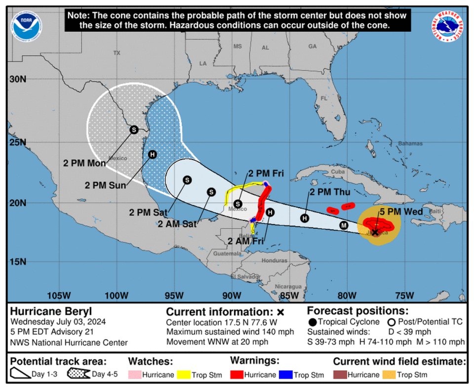
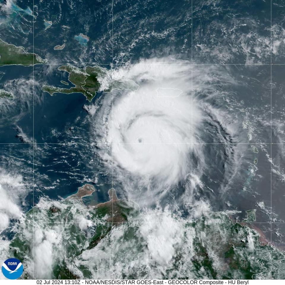
A powerful and record-breaking Hurricane Beryl churned toward Jamaica on Wednesday, where forecasters said would pound the island with life-threatening winds and storm surge before beating west across the Caribbean Sea, and eventually, the Gulf of Mexico.
Beryl — the earliest Category 5 storm ever in the Atlantic — turned its swirling eye on the Caribbean island of Carriacou on Monday, flattening or damaging most every building, local leaders have said. It killed at least six people across the southeast Caribbean before it pounded west, according to The Associated Press. It’s eye neared Jamaica Wednesday afternoon.
Forecasters said Beryl had weakened overnight and downgraded it to a Category 4 storm on Wednesday.
They have warned worried Gulf Coast residents for days that the storm’s track was uncertain once it neared the Gulf of Mexico. But a Wednesday morning forecast hinted at relief for communities across the eastern Gulf, including Louisiana and South Mississippi.
“The official forecast now shows Beryl becoming a hurricane before making landfall along the western coast of the Gulf of Mexico,” National Hurricane Center forecasters Lisa Bucci and Eric Blake wrote in a Wednesday morning discussion.
Where is Beryl headed next?
Beryl is moving west and will hit Jamaica on Wednesday, the NHC said. It poses no direct threat to South Mississippi or Louisiana, the National Weather Service in New Orleans said Tuesday night, although it warned the forecast was uncertain and residents should monitor updates.
Beryl’s eye will pass the Cayman Islands Wednesday night or early Thursday, then hit Mexico’s Yucatan Peninsula early Friday, the forecast said.
Its maximum winds on Wednesday afternoon were 140 miles per hour and had slowed from the 160 mile per hour forces forecasters measured earlier in the week.
Forecasters said they expect Beryl to weaken more through the week but that it would remain at “major hurricane intensity.”
It still remains unclear how strong the storm will be once it nears the Yucatan. Forecasters said their models disagree: one predicts the wind shear will decrease, which would rapidly weaken Beryl, but another shows a different atmospheric wind pattern would interfere less with the storm, which could keep it strong.
Bucci and Blake also wrote that regardless, the storm will likely strengthen over the Gulf of Mexico.
Atmospheric pressure over the southeastern United States has steered Beryl west over the past week. Forecasters said that pressure could weaken later this week in the Gulf and steer the storm northwestward, toward the coasts of Mexico and Texas.
And forecasters said on Wednesday evening that while the storm tracked toward Mexico, “a landfall in Texas cannot yet be ruled out.”
Beryl breaks records and signals dangerous hurricane season
Beryl is the earliest Category 5 storm to ever strike the Atlantic. Forecasters said it was also the earliest Category 4, the strongest June hurricane, the easternmost June hurricane and the first to rapidly intensify so early in the Atlantic.
And it was the first evidence of what the National Hurricane Center warned this spring: that the 2024 hurricane season could be the busiest and most dangerous yet.
Beryl is the first hurricane and second named system this year. Tropical Storm Chris formed late Sunday and its remnants dissipated heavy rain over eastern Mexico Monday morning, forecasters said. That system came just weeks after Tropical Storm Alberto pounded the southeastern Mexican coast in June. Alberto also sent storm surge through Texas and even brought minor flooding to low-lying areas of the Mississippi Coast.
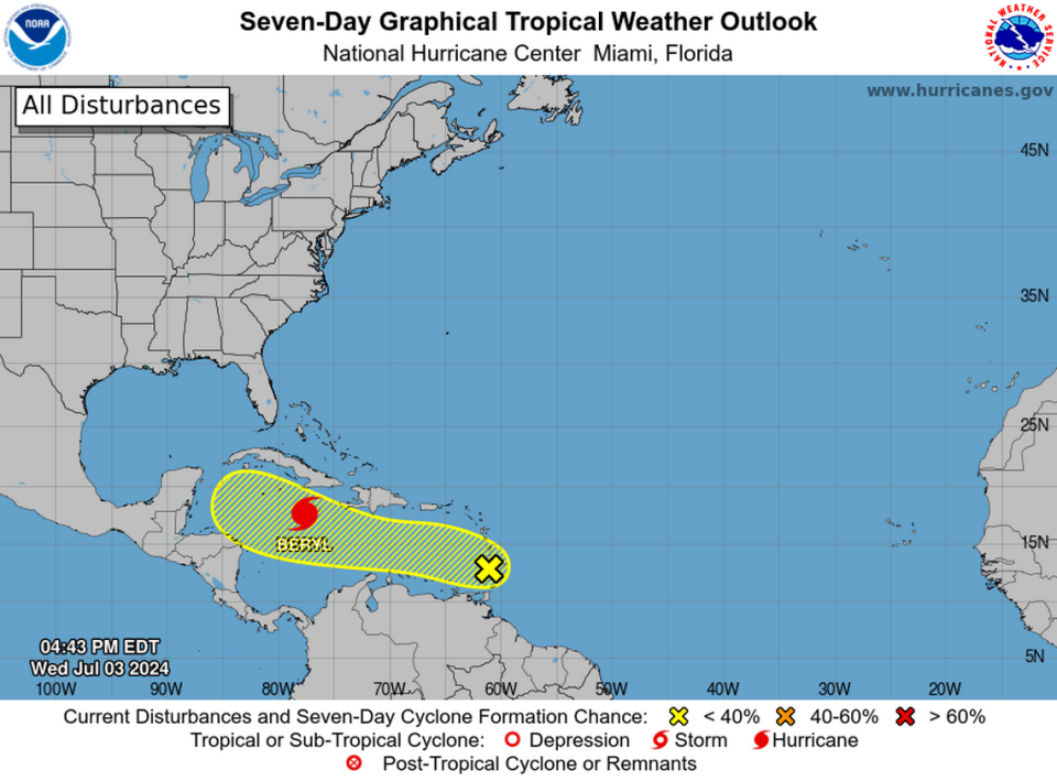
Forecasters are also tracking a disturbance that is traveling behind Beryl with just a 20 percent chance of development within seven days.
The three named storms strengthened in a season forecasters have already warned will be extraordinary. Fueled by record warm waters and calmer Atlantic winds, Beryl and Alberto became the first of 17 to 25 named storms forecasters predict will form before the season’s end on November 30.
Most hurricane seasons have just 14 named storms.