
Renewed severe storm risk sweeps eastwards across the Prairies
Monday brought an afternoon of active weather across parts of Alberta, with severe thunderstorms bringing high winds, large hail, and a tornado warning to the province.
Now that same system is shifting the thunderstorm risk to the eastern Prairies on Tuesday. With that brings a renewed risk for scattered, severe weather to Saskatchewan and Manitoba before the system finally moves out of the region and into Eastern Canada later in the week.
As storms continue to sweep through the Prairies, remember to regularly check for weather alerts and warnings.
Landspout TORNADO township road 200 south of okotoks #abstorm 244 pic.twitter.com/qOKzxnLXcZ
Landspout TORNADO township road 200 south of okotoks Darren Howard on Twitter: "Landspout TORNADO township road 200 south of okotoks #abstorm 244 pic.twitter.com/qOKzxnLXcZ / Twitter" 244 Darren Howard on Twitter: "Landspout TORNADO township road 200 south of okotoks #abstorm 244 pic.twitter.com/qOKzxnLXcZ / Twitter"
— Darren Howard (@lightningmanAB) Darren Howard on Twitter: "Landspout TORNADO township road 200 south of okotoks #abstorm 244 pic.twitter.com/qOKzxnLXcZ / Twitter"
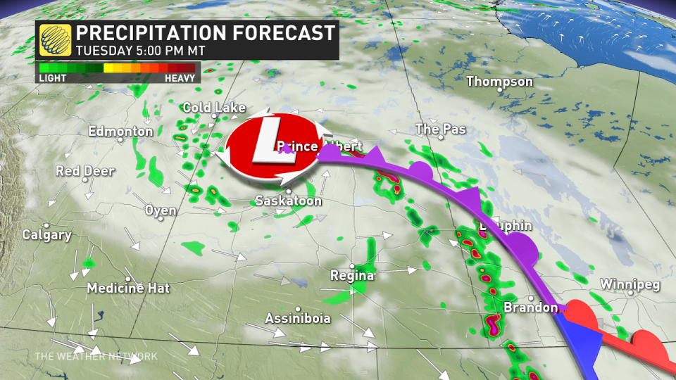
TUESDAY
Areas: Eastern Saskatchewan, southwestern Manitoba
Timing: Early afternoon to evening
Weather: A surface low that brought active weather and even a tornado warning to Alberta Monday, will continue its cross Canada tour this week. By Tuesday, its sights are on Saskatchewan, pressing into western Manitoba, where severe thunderstorm activity could bring widespread hazards.

A chance of rotation is possible within the storms that develop across the southern Saskatchewan-Manitoba border, triggered ahead of the low’s centre by the dinner hour. Throughout the day, a spiral of thunderstorms around the low itself also threaten central Saskatchewan, with gusty wrap around winds.
Large hail and gusty winds remain the primary threats, with the risk of a couple of tornadoes, embedded or of the landspout variety, are also possible along the trough of the low pressure system.
RELATED: Historic desert heat wave’s influence reaches all the way to Canada
Confidence: Confidence is high that Manitoba and Saskatchewan will have severe thunderstorm activity, but lower confidence on tornado potential with the storms and timing.
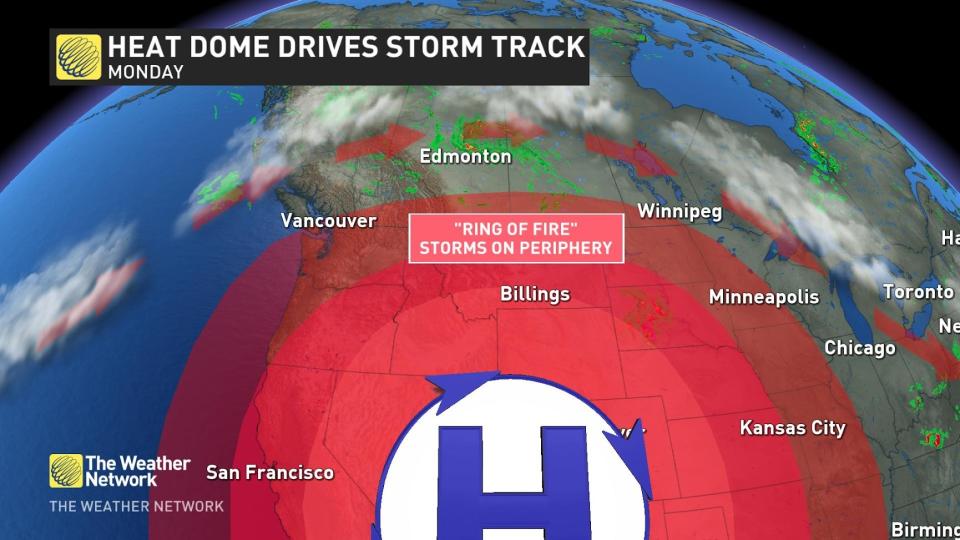
Although the heat dome over the United States is well south, it’s still playing a role in developing our storm track around the outside of the sprawling high pressure ridge.
Keep checking back to The Weather Network for more updates and forecast information on your weather across the Prairies.

